38.86400, – 120.06641 Lat/Long.
For many of us August is the vacation month. It is the last summer month before school begins again. We always headed for the mountains toward the end of August when it was often the foggiest time in the Berkeley Hills. It was less than a half-day’s drive to reach our vacation lake in the high Sierra.
I hope this story about our vacation will prompt you to remember your summer vacation, and maybe even write about it. Your family will love it.
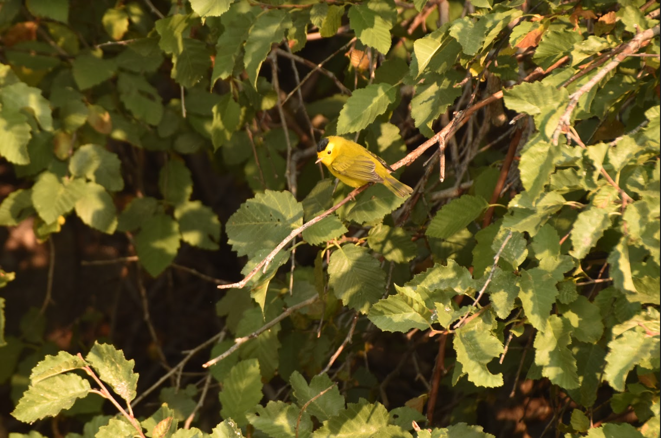
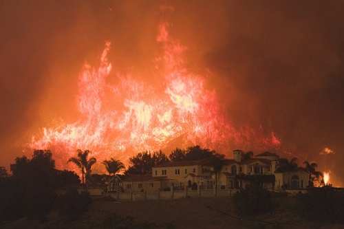
When I learned that the Caldor fire last August had veered south, sparing Angora Lake, I was overwhelmed with gratitude. Had it taken a near miss to remind me of my 70-year devotion to this high Sierra Lake? A day later, Judith Hildinger, who with her brother Eric, runs the Angora Lakes Resort took the photo from her paddle board of a beautiful male Wilson’s Warbler sheltering in the mountain alder. Even though it was still smoky, I asked her to take more pictures around the lake’s edges because I wanted to write a long-overdue love letter to Angora.

I’ll start the photographic journey at the alder thicket next to the beach. The thicket had always been a safe place for nesting warblers in the summer. Not being able to penetrate the thicket from the beach, the best I could do was to push my boat as close to the shore as possible before being warded off by the wiry branches. I dropped my oars and sat listening to the small bird voices.
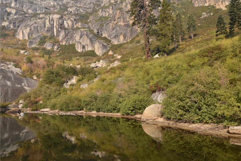
Beyond the mountain alders, an even denser pygmy forest of huckleberry oak, flows down the steep slope to the water’s edge. The huckleberry oak is the only high elevation oak in the big family of oaks, the most populous tree family in California. The huckleberry oak’s thin, flexible branches allow the tree to sprawl prostate over granite boulders. In a region of short summers, the acorn takes two autumns to mature. Once ripe, the little acorn is a favorite food of chipmunks and other small rodents.
It’s been years since I struggled up that slope to the ledge with the dwarf conifers where we had buried Don’s ashes. There was no other place he would have wanted to be.
It was a late afternoon in October when we arrived at the lake. The cliff and lake were in shadow. The cabins were boarded up and the boats stored away. I was anxious to be ahead of the first snow. It would have been next spring before we would have access again.
After tucking the ashes beneath a dwarf conifer on the first ledge, the girls and I returned to the beach. Jim stayed back as he grieved for his lost father.
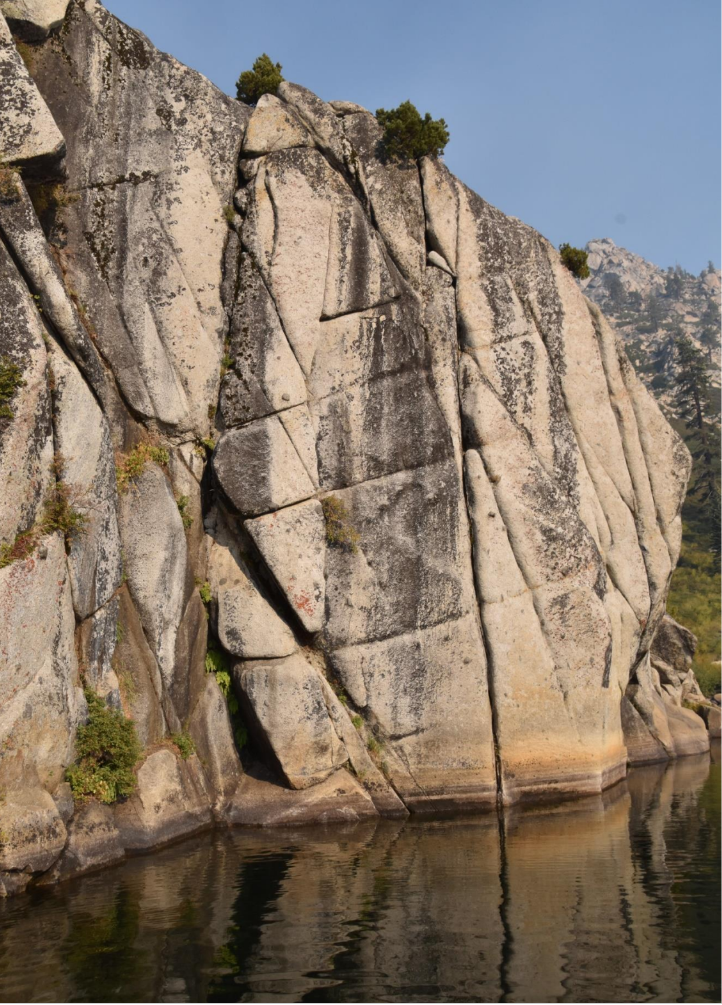
Around the corner from the oaks come the cliffs which distinguish upper Angora Lake from most other lakes. I always think this massive wall must be at least 10,000 feet high but in reality it reaches less than 9,000 feet, about 1,500 above the lake level. Sometimes even reality goes out the window when I think of Angora. Since I’m unable to travel any longer, Angora remains fixed in my mind and my heart and I want to get it right.

The cliff faces are streaked with chartreuse and dark brown lichens. By releasing an acid, the lichen slowly ingests the granite. Wherever there is a little soil in a crack, a seed or spore may take root producing delicate ferns or flowers. Further up on a face, a stout juniper with long ropy roots, has taken hold and found a home.
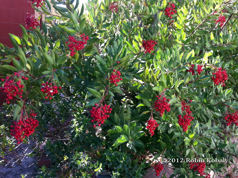
From the top at Echo Peak, the cliff descends to the lake interrupted only by occasional narrow ledges each with a miniature garden of quaking aspens, grasses and clumps of mountain ash with its vibrant red berries. Only in the driest years does water fail to trickle into the lake as miniature waterfalls. Often in late August a snow patch clings to the edge of the highest ridge.
One of the family rituals was to watch the rising sun first ignite Echo Peak with its golden light and then the sun slowly slides down the face to the lake level. I am always amazed how sunlight restores color, animating whatever it touches.
Just around the corner from where the cliffs end, a small grove of mountain hemlocks thrive in the cool shade. The hemlocks love the snow and winter. They often grow where the snow lasts the longest. John Muir wrote that if you were caught out in a blizzard, climb under the hemlock branches which reach down to the ground, and you will be sheltered.
I can’t remember the details of this north-facing shore of the lake. Of course there’s Frog Rock, the rock islet with its single tree. The steep slope of rocks and trees behind culminate in what we simply call The Ridge.
Ah, there’s something else about the ridge that allows me to stray off course. On a morning maybe sixty years ago when I was preparing breakfast on the wood stove with the door wide open, the roar of an engine startled me and I looked up to see a heavy-bodied two-engine plane skimming the ridge and dropping down over the lake, releasing a cloud of water filled with young trout. The plane pulled up abruptly and headed northeast toward Desolation Valley, delivering fish to other lakes.
Now, where was I? Oh, yes, near the cabins at the east end of the lake is a seasonal creek which links Upper and Lower Angora Lakes. When we were there in late August, the creek was usually dry, but I always enjoyed the sheltered ravine populated by some nice flowering shrubs like the Western Serviceberry and Western Spiraea. I liked to bring along a plant book for the satisfaction of giving a plant a name which always seemed to make it a friend.
One cabin, alone, occupied a space just south of the creek with a level place in front where you could pull up a boat. Though the cabin was too small for a family, I loved its separateness. It was one of the old-style cabins with a drop-down front which reminded me of my desk at home that concealed some of my treasures.
When the Forest Service revealed its plans to put in a campground on the site, the cabin was hoisted up on logs and eased across the creek to join the other cabins. Either the Forest Service came up short on money or the entreaties of people like us to leave the lake alone prevailed.

The other cabins were built side by side on a level area which may have been the glacial moraine formed during the time when glaciers scooped out the depressions which later filled with melting snow becoming the two lakes and the pond. When I think back to how this beautiful amphitheater, its cliffs, waterfalls, and peaks were formed, I wonder what the future holds. In a drier and hotter climate will the lakes become meadows or disappear altogether? And will the landscape, succumbing to fires, lose its conifers and become brush land or oak savannah? Will we have to ascend to 10,000 feet to find the Sierra we once loved?
I just looked at a random collection of photos taken by visitors of some of the handmade sign’s advertising: “The World-famous Lemonade;” “Angora Lakes Resort has been operating since 1917.” One photo showed a smiling Effie Hildinger, the original proprietress, who rode in on mule back in 1924. And a brown and yellow official Forest Service sign informed visitors that this is Angora Lakes Resort, National Forest Lands in the Lake Tahoe Basin.
My particular affection is for a cabin called The Lodge where we would have weekly slideshows in the summer. It was furnished with a well-used upright piano, chairs of various vintages and a loom. I spent many afternoons sitting on the small porch in the warm afternoon sun listening to various musicians — most often Gloria Hildinger on her flute, sometimes Jim Hildinger and his violin, and occasional visitors like Jan Popper on the piano and a cellist from Fallen Leaf on her cello.
And will I ever forget that early morning when Jim pulled his big speaker to the open doorway and filled the amphitheater with the glorious strains of Sibelius’ violin concerto.
Sibelius would have loved this place.

I sometimes walked the road down to Lower Angora Lake where occasional avalanches descending the steep slopes below Angora Peak would knock down a tree or two, blocking the road. I was always eager to visit one of the big red firs where the chartreuse, fragrant wolf lichen clinged to the ruddy bark. You can find the lichen mostly on the north side of the tree, just above the line where the trunk is free of snow. Lower Angora, with its scattering of cabins, lacks the dramatic setting of the upper lake.
Up the short hill is “Our House, ” the house where the Hildingers and their two young boys lived through winter in the 1930s. I remember one story where they would troop down to the ridge and holler down to the caretaker at Fallen Leaf Lodge and he would holler back. That was the social activity for the day.

“Our House” was distinguished by the aspen trees which grew close around the paned windows. The cabin was alive with dancing light when the leaves trembled in the slightest breeze. After lunch we would lie on the bed, listen to the voices of the kids below on the beach with the sparkling water reflected on the underside of the low eave.
I’m thinking of windy nights. The wind would come in gusts that sounding like an approaching freight train with spaces of eerie silence between. With our headboard against the single wall, we wondered if it would hold.

On this south-facing slope, the shrubs are very different from the mostly deciduous ones that grow in the protected swale along the creek. Just below the deck of “Our House” was a mountain chaparral garden composed as if by the most talented landscape designer. Several species shared the same slope – a low-growing silver-leafed plant called snow brush (Ceanothus cordulatus), a stunning bush Chinquapin with shiny yellowish leaves, more golden on the undersides with a spiny burr that encloses two or three seeds. One afternoon I discovered beneath the dense cover a hard-to-find bird I had never seen before: a Green-tailed Towhee.

It seems all paths led to the beach when our kids were little. The sand was a granular granite with sparkles of mica like that of the parent rock. The beach was narrow when the lake was high, usually in early summer, wide in the late summer when the lingering snow banks on the ridge had melted. I liked lying on my back and watching clouds moving over the peak toward the east. I speculated about whether a cloud would make it across my field of vision before dissolving. Fair weather clouds are generally short-lived.
It was at the beach that kids won a rite of passage – swimming across the lake and back. The reward was dad saying they no longer had to wear a life jacket when in a boat.
The other rite was to climb up the steep slope to the top of Echo Peak and then hollering “Echo” down to listeners below. As I recall, the reward for the climb was a cold glass of fresh lemonade.
We didn’t discover Angora by accident. It was a carefully engineered plan by my parents who once stayed at Angora when meals were served in the dining room by Jim and Effie. Once Jim went into the Army, the cabins were provided with modest cooking facilities, and the dining room was closed. My parents went elsewhere returning only for our inauguration.
We arrived in the afternoon, my parents greeting us at the doorway and my mother giving me instructions about how to be a good housekeeper, Angora style. “NEVER let any food particles go down the drain!” and with that, they departed down the hill in Jim’s truck as we would do for many years until our nest was empty.
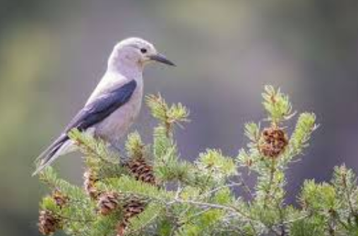
Though our traditional week was the last week of August when the Berkeley Hills were the foggiest, we visited twice at other times for a day. Once was in June – spring in the Sierra when the meadows were wet and green and birds sang everywhere. Angora was transformed by robin song. By late summer, we were left with the harsh voices of Steller’s Jays and the chatter of squirrels and chipmunks. Toward the end of our stay, Clark’s Nutcrackers called as they began moving down from the higher mountains ahead of winter.
Probably the strangest visit to Angora was the first day of the new year before the arrival of the winter snows. The lake before us was frozen and the sun was about to set behind Echo Peak. Once the sun disappeared, we were cold. But what detained us was a deep growling sound coming from across the lake near the cliffs. What was that? Bear, mountain lion? Feeling unwelcome in this unfamiliar Angora, we hurried down the hill until near the Lookout ridge we regained the sun. Later, we learned we had heard the scrapping of the ice against the cliff. Maybe the sound was distorted and amplified by the ice itself or by the cold, deep water below.

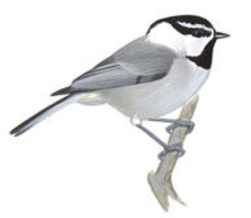
Usually after a few days of being under the lee of the cliff, I was ready for some distant views. Walking down the hill to the pond and the big flat area open to the sky, I could see to the south the familiar shapes of the peaks around Carson Pass. The tall Jeffrey Pines are widely spaced. From the upper branches came the clear, three notes of the Mountain chickadee and the somnolent buzzy song of the Western pewee which always made me drowsy on warm Sierra afternoons.
I headed back up the hill for a nap.
 After having lived most of my life in the Bay Area, California mountains meant only the Sierra Nevada. My earliest memories are of Lake Tahoe with the bands of blue, the color deepening the further you were from shore. I remember the translucency of the water, the whiteness of the beach sand and the way the sun shining through the water left a dazzling pattern on the sandy bottom. And the granite, always angular and glistening with feldspar.
 The San Bernardino Mountains rise abruptly on all sides out of its arid landscape. The curving road makes a quick ascent passing occasional coulter and knobcone pines, dried stalks of yuccas and chaparral. In a land of few lakes, only dams can create a body of water, gathered mostly from snow melt. Big Bear Lake, no exception, occupies its own shallow valley set in low mountains and open conifer forests. Unlike the Sierra, where millions of trees have succumbed to the long drought and insect attacks, Big Bear’s trees look healthy, perhaps being accustomed to dry years.
 Because we were nine people, we rented a large, recently remodeled house which is currently on the market for three and a half million dollars. While the family took to kayaks and paddle boards, I settled in on the deck to figure out this place.
 But what took my fancy was the pair of sugar pines above a neighbor’s roof. Aside from being both the largest and second tallest in the pinus family with uncommonly long pine cones, I love this pine. John Muir savored the exuded gum which he said was sweeter than maple-syrup. The branches are arranged on the straight trunk often symmetrically, but sometimes a branch will shun order and stretch out further than the rest. Cones hang near the tip of the branch. I remember watching them in a winter wind swaying as if they were extravagant ornaments. Once, while examining a cone a foot and a half long lying on the ground, I remember someone telling me that the scales expand and contract with the change of temperature and the prickles make a grove in the soil for the seed. I’ve never been able to find another citation for that charming “fact” since.
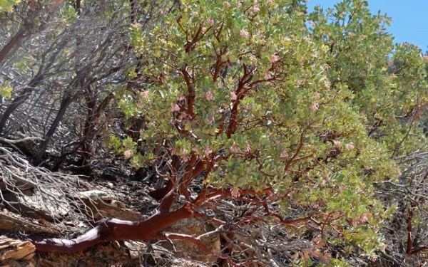 Time to shake off the lethargy that comes with an occasional fleecy cloud drifting across the blue and then dissolving or the soft song of pines, and explore the rest of the lake. The dam is a modest one required only to hold back the snow melt and the marshy waters in the shallow basin. Once around the corner to the drier south-facing shore, sages and the sturdy Sierra juniper make an appearance.
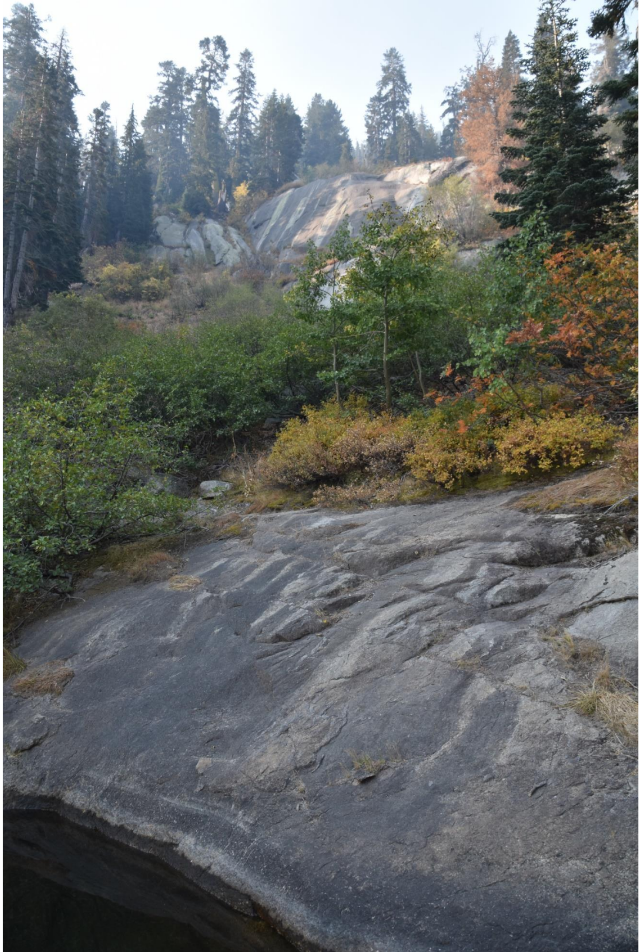
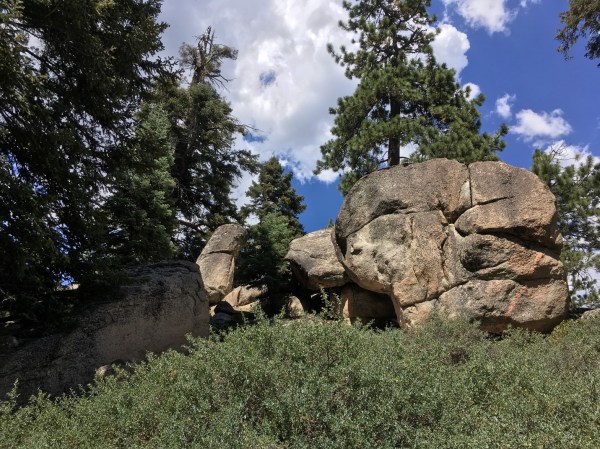 Once we turned off the road that circles the lake, we were in the forest headed uphill. We pitched and heaved over the bumpy road. But once in this sub-alpine forest we felt like we were back in the forests above Lake Tahoe. Though I am considered the chief exclaimer in the family, we all exclaimed over this familiar beauty. No more yellowish rock. Here the granitic core of the mountain revealed itself. The understory became varied – sometimes tender green fields of bracken ferns, other times corn lilies.
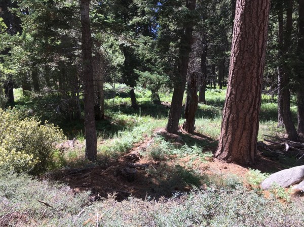 We parked at the end of the road where a sign pointed downhill to the lodgepole pine and to the Bluff Lake Preserve. I recognized this kind of trail – decomposed granite made “interesting” by rocks and exposed roots. My grandson Stuart walked close behind me and my daughter ahead of me. I focused on what was underfoot allowing only sidelong glances at the creek next to the trail over hung with
  wildflowers, the first such sight in these mountains. The trail leveled out as we approached the lodgepole pine grove. Lodgepole pines are uncommon in this southern forest. They hark back to a cooler era. My joy was somewhat tempered by remembering that I had to walk back out. I didn’t care. I hadn’t expected this gift in my 89th year.
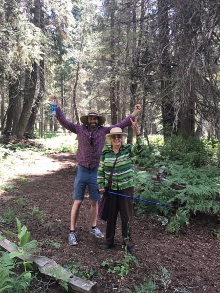
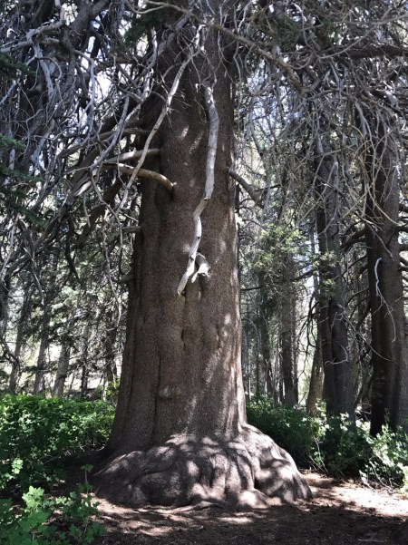 The noble tree is a part of a national registry of the largest known of its species in a particular geographic area. A nearby Jeffrey pine is several hundred years old, an “old growth” survivor in a forest that had been heavily logged


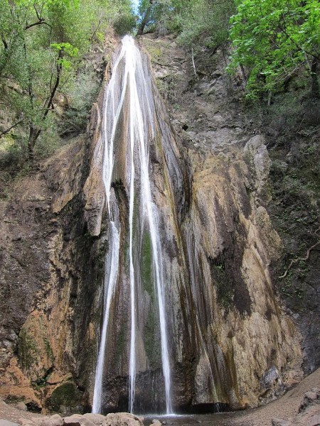


 The final ascent on stone steps to the base of the falls looked damp, making them especially perilous for my old legs. A bench at their base invited me to sit a while, let my granddaughter
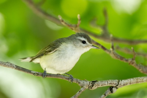
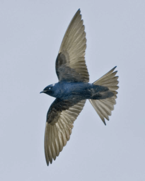
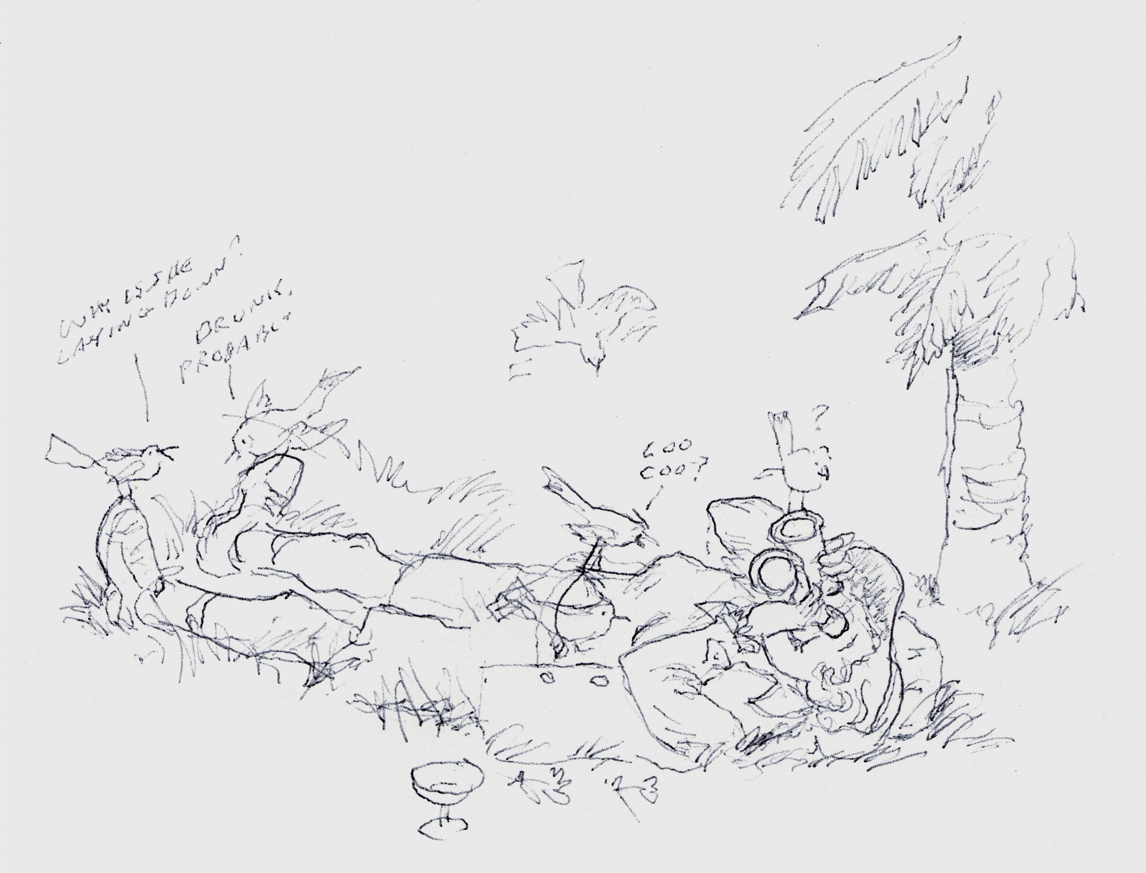
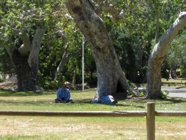 Three weeks later with Berkeley birding friends, Bob Lewis and his wife, Hanno, we returned to Nojoqui Falls park to find the Purple Martins. Bob is sitting on the left. The heap on the right is actually me lying on my side watching martins in flight. Stretched out, has become my preferred position for watching birds of the sky and for general cloud-spotting.(I highly recommend to others who love clouds “The Cloudspotter’s Guide by Gavin Pretor-Pinney – the founder of The Cloud Appreciation Society)
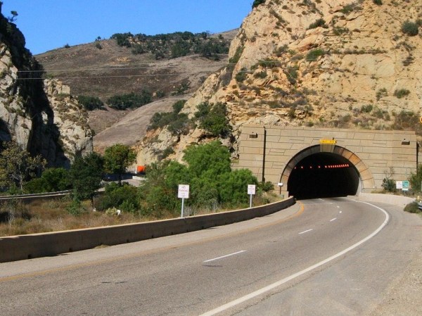
 If you have lived a natural life say as a manzanita bush on the slope of the San Ynez Mountains you will understand the true meaning of summer. You will have grown new foliage or lengthened the leaves you have during late winter or early spring. You will have flowered and welcomed the bees. Now the flowers have turned into fruit, it’s time to let them ripen in the warm sun of the long days. It’s a season for repose or maybe deepening, as your tap root reaches down further to find water.