Summer Doldrums

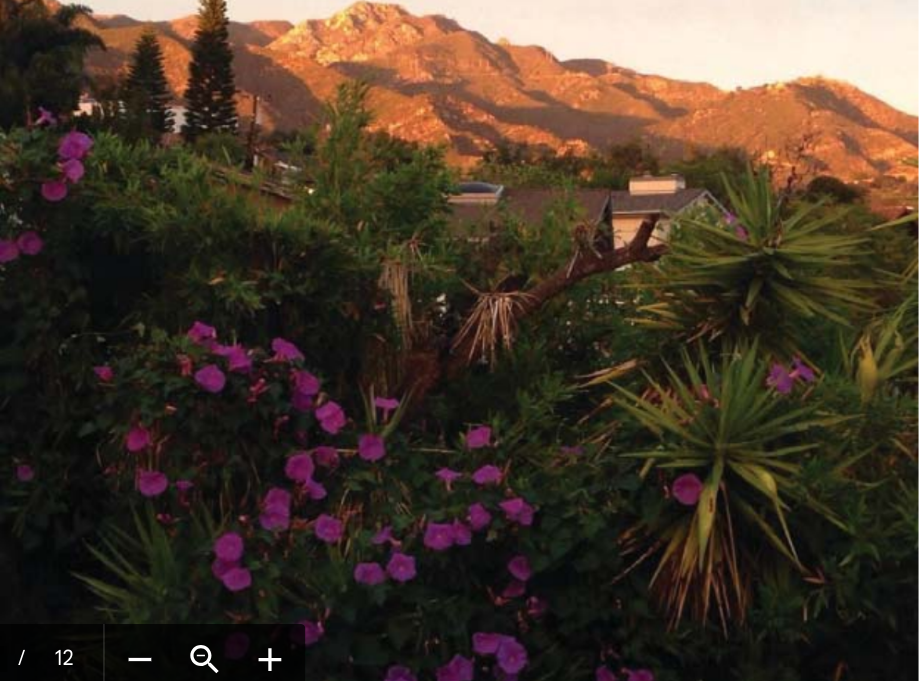
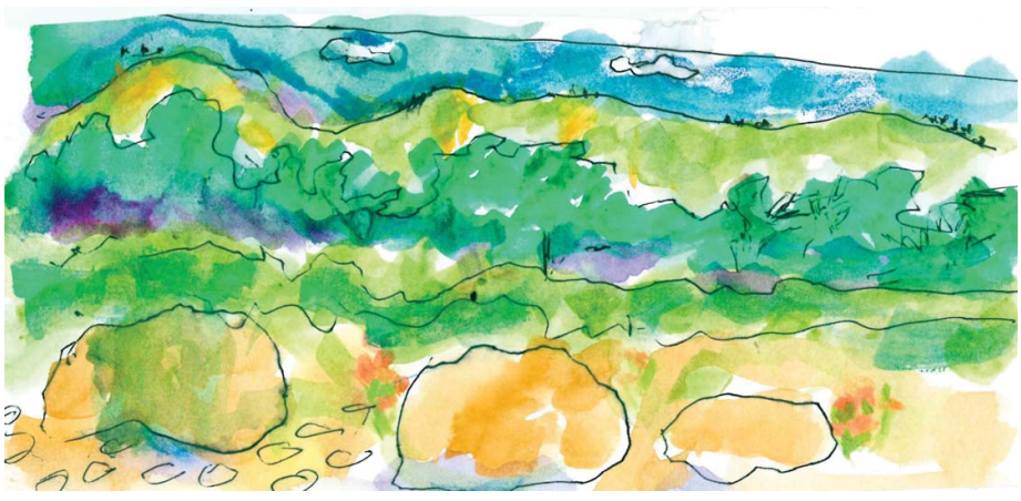
When my daughter and her family bought a house on a ridge looking directly into the Santa Ynez mountains, I was delighted. These are the canyons and mountains where my dad and grandfather used to explore and hunt when my dad was a boy. That first winter, when the rain clouds lifted, it revealed cliffs laced with waterfalls. In February, blooming chaparral dusted the mountains with white flowers and in April with blue blooms.

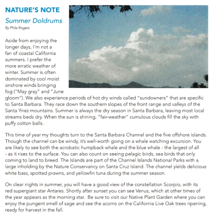
Chaparral is my favorite plant community, with its dense shrubs superbly adapted to long hot summers and short wet winters. The Santa Ynez mountains have their own climate, notably the sundowner winds which roar downslope raising temperatures and fanning fires. They are the western-most transverse range which is bent along the San Andreas fault, explaining why Santa Barbara faces south instead of west.
The mountain rocks are studded with fossils of sea creatures laid down from the millennia when the region lay under a warm sea. The rugged mountains cut off Santa Barbara from the north until late in the 19th century.
When my 95th birthday came around in the first week of April, I suggested to my son that we take a ride over the mountains to the Santa Ynez Valley. In this second generous winter in a row when rainfall exceeded the annual normal, I was eager to see the green landscape. My son doubted I could see much.
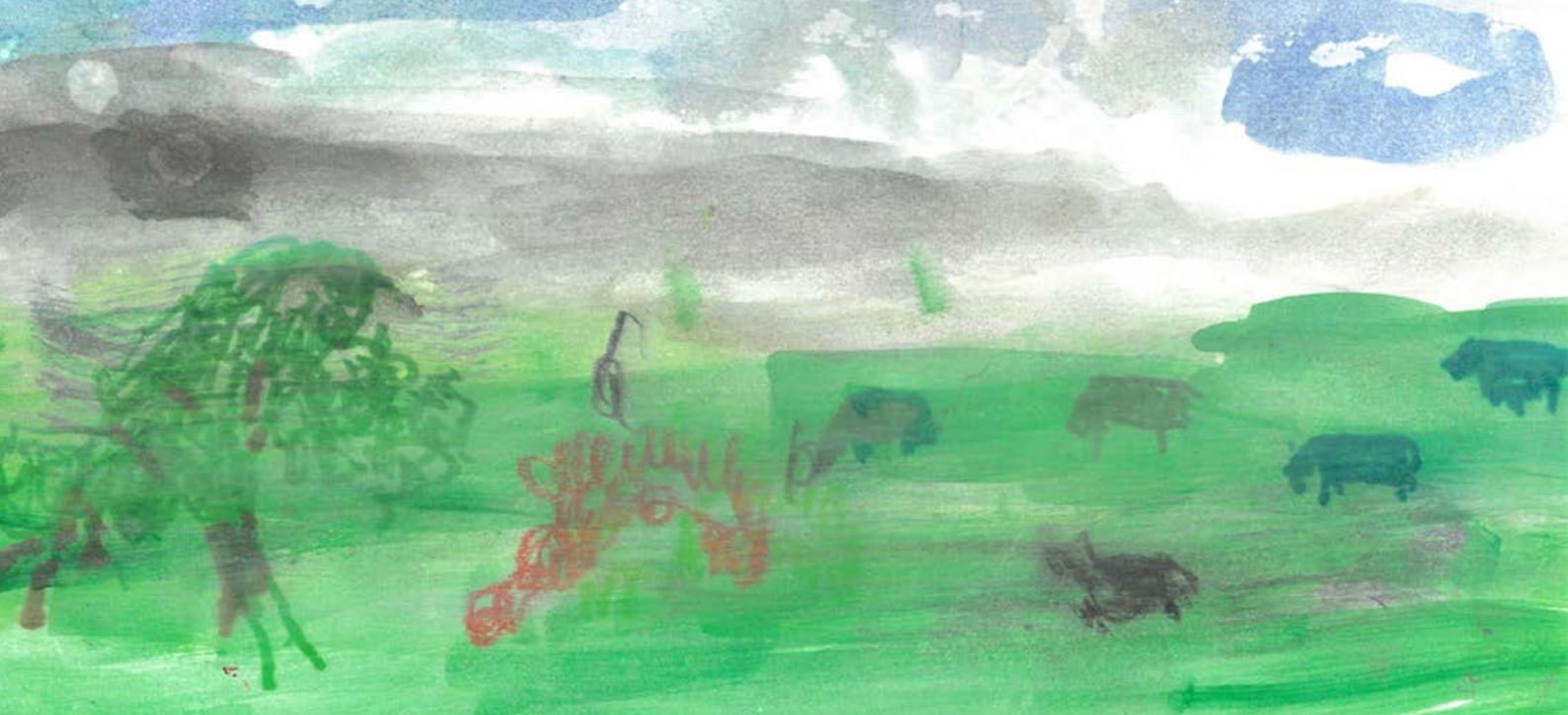
But I had a new strategy. I would look carefully and then I would employ what I call “historical memory.” When I saw the elegant Valley Oak in its pasture I remembered from earlier times its far reaching branches and the scalloped leaves unfurling. I saw the black cattle and I recalled again how they stood belly deep in the fresh grass. When we passed a small tree with billowing pale blossoms, I knew it was a light blue ceanothus.

Life is different now that I have lost half my eyesight. It is a softer world, as if enveloped in a light haze. I’m taking out my paints again so I can show you what I mean and how each vivid orange poppy still calls attention to itself. And above all, the skies filled with April clouds truly speak to me with their vaporous edges and changing shapes.

Shirley Roby was born at Cottage Hospital in 1942. Home was just around the corner near Oak Park. Before she was a year old, she and her parents moved to Hillcrest Road on the back side of the Riviera. The home had generous gardens, a pond and is still the family home, presently occupied by her daughter and husband.
With no school bus serving children in the hills, most mornings Shirley traveled down the hill to Jefferson Elementary School with her father, who was a banker in town. Her mother was a local historian who wrote regular columns in the Santa Barbara News- Press and authored a book about the Santa Barbara Fiesta.
Shirley started playing the violin at 5 years old and, like Alita Rhodes, played in the city-wide summer orchestra and went to YWCA camps at Pine Mountain and on Catalina Island.
After graduating from Santa Barbara High School, she headed north to attend Lewis and Clark College in Portland, which is where she met her husband-to-be, Kib.


The Eastern Sierra drew the family away over the years, first to Lake Mary and then to – Lake George. Later, Shirley and Kib (assisted by their two children) owned and operated the Rock Creek Lodge – at 9,300 feet, a popular jumping-off place for hikers and fishermen.
When I got to know fellow Samarkand resident Irene Coker, I learned she had her own Santa Barbara story. Though born in Santa Barbara, she grew up elsewhere, returning when she was 18 years old. But her great-uncles had come to Santa Barbara years before from Italy, working first as gardeners in Mission Canyon and then later as stone masons, constructing walls near the Mission.
It was the talented stone masons from Italy who gave Santa Barbara its distinctive look with their handcrafted buildings, walls and bridges, many made using our local sandstone.
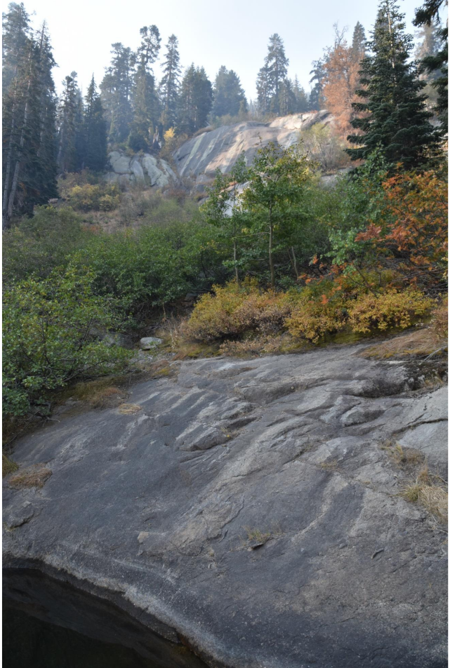
A trip to the Santa Barbara Botanic Garden in Mission Canyon will show you even earlier uses of sandstone. In a climate with a short rainy season, the Mission Fathers realized they would have to store water to see them through the long dry season. You can still see the dam built by the Chumash people in the early 1800s under the supervision of the Mission Fathers. The water was impounded by the dam and later traveled down to the Mission gardens via aqueducts. At the Garden, you can also see one of the immense boulders brought down from the mountains in an earlier debris flow.

I love the sandstone features all over town, I’m glad most of the sandstone remains on the mountain slopes, because when we walk at the end of the day the setting sun turns the sandstone a glowing orange as if illuminated from within.
I lived most of my life in the Berkeley Hills where I looked west through the Golden Gate knowing that it is the only sea level break along the coastal mountains. At night, two lighthouse beacons told me where I was – one flashing light on Alcatraz Island just inside the Gate and the other 25 miles offshore on the Farallon Islands.
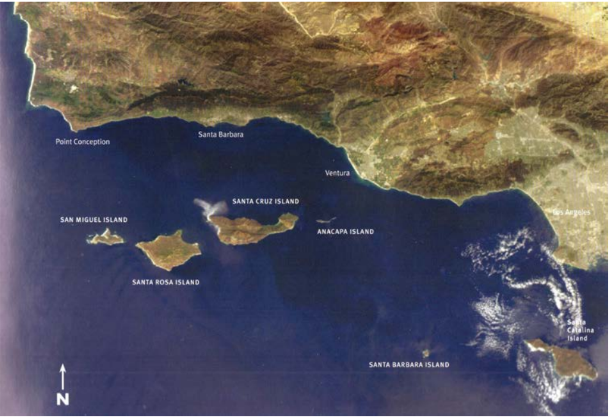
When I first came to Santa Barbara, I looked for what might be special. I admired the mountains at the edge of town which are twice as high as the Berkeley Hills. Then l remembered that in Santa Barbara you looked due south to the ocean because 30 miles west at Point Conception, the coastline turns abruptly 90 degrees east. Near Ventura the coastline straightens up again and resumes its roughly north/south trend of the rest of the California coastline.
On clear days I can see the profiles of Santa Cruz and Santa Rosa Islands which are part of the five Northern Channel Island group, giving Santa Barbara another distinction in a state with few offshore islands.
And how about another fact: it is the motion of the San Andreas fault over time that has twisted the coastal mountains in the region to also run east/west, which is why on the maps they are referred to as the Transverse Ranges.
But aside from all the interesting geology, what I truly love about the mountains behind Santa Barbara is the way they reflect back the low winter sun to help give us the mild winter climate.

For many of us August is the vacation month. It is the last summer month before school begins again. We always headed for the mountains toward the end of August when it was often the foggiest time in the Berkeley Hills. It was less than a half-day’s drive to reach our vacation lake in the high Sierra.
I hope this story about our vacation will prompt you to remember your summer vacation, and maybe even write about it. Your family will love it.
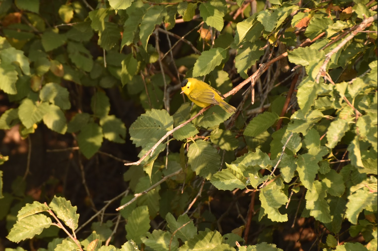
When I learned that the Caldor fire last August had veered south, sparing Angora Lake, I was overwhelmed with gratitude. Had it taken a near miss to remind me of my 70-year devotion to this high Sierra Lake? A day later, Judith Hildinger, who with her brother Eric, runs the Angora Lakes Resort took the photo from her paddle board of a beautiful male Wilson’s Warbler sheltering in the mountain alder. Even though it was still smoky, I asked her to take more pictures around the lake’s edges because I wanted to write a long-overdue love letter to Angora.

I’ll start the photographic journey at the alder thicket next to the beach. The thicket had always been a safe place for nesting warblers in the summer. Not being able to penetrate the thicket from the beach, the best I could do was to push my boat as close to the shore as possible before being warded off by the wiry branches. I dropped my oars and sat listening to the small bird voices.
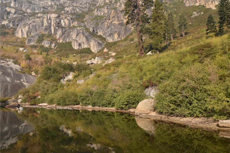
Beyond the mountain alders, an even denser pygmy forest of huckleberry oak, flows down the steep slope to the water’s edge. The huckleberry oak is the only high elevation oak in the big family of oaks, the most populous tree family in California. The huckleberry oak’s thin, flexible branches allow the tree to sprawl prostate over granite boulders. In a region of short summers, the acorn takes two autumns to mature. Once ripe, the little acorn is a favorite food of chipmunks and other small rodents.
It’s been years since I struggled up that slope to the ledge with the dwarf conifers where we had buried Don’s ashes. There was no other place he would have wanted to be.
It was a late afternoon in October when we arrived at the lake. The cliff and lake were in shadow. The cabins were boarded up and the boats stored away. I was anxious to be ahead of the first snow. It would have been next spring before we would have access again.
After tucking the ashes beneath a dwarf conifer on the first ledge, the girls and I returned to the beach. Jim stayed back as he grieved for his lost father.
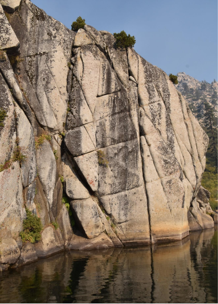
Around the corner from the oaks come the cliffs which distinguish upper Angora Lake from most other lakes. I always think this massive wall must be at least 10,000 feet high but in reality it reaches less than 9,000 feet, about 1,500 above the lake level. Sometimes even reality goes out the window when I think of Angora. Since I’m unable to travel any longer, Angora remains fixed in my mind and my heart and I want to get it right.

The cliff faces are streaked with chartreuse and dark brown lichens. By releasing an acid, the lichen slowly ingests the granite. Wherever there is a little soil in a crack, a seed or spore may take root producing delicate ferns or flowers. Further up on a face, a stout juniper with long ropy roots, has taken hold and found a home.
From the top at Echo Peak, the cliff descends to the lake interrupted only by occasional narrow ledges each with a miniature garden of quaking aspens, grasses and clumps of mountain ash with its vibrant red berries. Only in the driest years does water fail to trickle into the lake as miniature waterfalls. Often in late August a snow patch clings to the edge of the highest ridge.
One of the family rituals was to watch the rising sun first ignite Echo Peak with its golden light and then the sun slowly slides down the face to the lake level. I am always amazed how sunlight restores color, animating whatever it touches.
Just around the corner from where the cliffs end, a small grove of mountain hemlocks thrive in the cool shade. The hemlocks love the snow and winter. They often grow where the snow lasts the longest. John Muir wrote that if you were caught out in a blizzard, climb under the hemlock branches which reach down to the ground, and you will be sheltered.
I can’t remember the details of this north-facing shore of the lake. Of course there’s Frog Rock, the rock islet with its single tree. The steep slope of rocks and trees behind culminate in what we simply call The Ridge.
Ah, there’s something else about the ridge that allows me to stray off course. On a morning maybe sixty years ago when I was preparing breakfast on the wood stove with the door wide open, the roar of an engine startled me and I looked up to see a heavy-bodied two-engine plane skimming the ridge and dropping down over the lake, releasing a cloud of water filled with young trout. The plane pulled up abruptly and headed northeast toward Desolation Valley, delivering fish to other lakes.
Now, where was I? Oh, yes, near the cabins at the east end of the lake is a seasonal creek which links Upper and Lower Angora Lakes. When we were there in late August, the creek was usually dry, but I always enjoyed the sheltered ravine populated by some nice flowering shrubs like the Western Serviceberry and Western Spiraea. I liked to bring along a plant book for the satisfaction of giving a plant a name which always seemed to make it a friend.
One cabin, alone, occupied a space just south of the creek with a level place in front where you could pull up a boat. Though the cabin was too small for a family, I loved its separateness. It was one of the old-style cabins with a drop-down front which reminded me of my desk at home that concealed some of my treasures.
When the Forest Service revealed its plans to put in a campground on the site, the cabin was hoisted up on logs and eased across the creek to join the other cabins. Either the Forest Service came up short on money or the entreaties of people like us to leave the lake alone prevailed.

The other cabins were built side by side on a level area which may have been the glacial moraine formed during the time when glaciers scooped out the depressions which later filled with melting snow becoming the two lakes and the pond. When I think back to how this beautiful amphitheater, its cliffs, waterfalls, and peaks were formed, I wonder what the future holds. In a drier and hotter climate will the lakes become meadows or disappear altogether? And will the landscape, succumbing to fires, lose its conifers and become brush land or oak savannah? Will we have to ascend to 10,000 feet to find the Sierra we once loved?
I just looked at a random collection of photos taken by visitors of some of the handmade sign’s advertising: “The World-famous Lemonade;” “Angora Lakes Resort has been operating since 1917.” One photo showed a smiling Effie Hildinger, the original proprietress, who rode in on mule back in 1924. And a brown and yellow official Forest Service sign informed visitors that this is Angora Lakes Resort, National Forest Lands in the Lake Tahoe Basin.
My particular affection is for a cabin called The Lodge where we would have weekly slideshows in the summer. It was furnished with a well-used upright piano, chairs of various vintages and a loom. I spent many afternoons sitting on the small porch in the warm afternoon sun listening to various musicians — most often Gloria Hildinger on her flute, sometimes Jim Hildinger and his violin, and occasional visitors like Jan Popper on the piano and a cellist from Fallen Leaf on her cello.
And will I ever forget that early morning when Jim pulled his big speaker to the open doorway and filled the amphitheater with the glorious strains of Sibelius’ violin concerto.
Sibelius would have loved this place.

I sometimes walked the road down to Lower Angora Lake where occasional avalanches descending the steep slopes below Angora Peak would knock down a tree or two, blocking the road. I was always eager to visit one of the big red firs where the chartreuse, fragrant wolf lichen clinged to the ruddy bark. You can find the lichen mostly on the north side of the tree, just above the line where the trunk is free of snow. Lower Angora, with its scattering of cabins, lacks the dramatic setting of the upper lake.
Up the short hill is “Our House, ” the house where the Hildingers and their two young boys lived through winter in the 1930s. I remember one story where they would troop down to the ridge and holler down to the caretaker at Fallen Leaf Lodge and he would holler back. That was the social activity for the day.

“Our House” was distinguished by the aspen trees which grew close around the paned windows. The cabin was alive with dancing light when the leaves trembled in the slightest breeze. After lunch we would lie on the bed, listen to the voices of the kids below on the beach with the sparkling water reflected on the underside of the low eave.
I’m thinking of windy nights. The wind would come in gusts that sounding like an approaching freight train with spaces of eerie silence between. With our headboard against the single wall, we wondered if it would hold.

On this south-facing slope, the shrubs are very different from the mostly deciduous ones that grow in the protected swale along the creek. Just below the deck of “Our House” was a mountain chaparral garden composed as if by the most talented landscape designer. Several species shared the same slope – a low-growing silver-leafed plant called snow brush (Ceanothus cordulatus), a stunning bush Chinquapin with shiny yellowish leaves, more golden on the undersides with a spiny burr that encloses two or three seeds. One afternoon I discovered beneath the dense cover a hard-to-find bird I had never seen before: a Green-tailed Towhee.

It seems all paths led to the beach when our kids were little. The sand was a granular granite with sparkles of mica like that of the parent rock. The beach was narrow when the lake was high, usually in early summer, wide in the late summer when the lingering snow banks on the ridge had melted. I liked lying on my back and watching clouds moving over the peak toward the east. I speculated about whether a cloud would make it across my field of vision before dissolving. Fair weather clouds are generally short-lived.
It was at the beach that kids won a rite of passage – swimming across the lake and back. The reward was dad saying they no longer had to wear a life jacket when in a boat.
The other rite was to climb up the steep slope to the top of Echo Peak and then hollering “Echo” down to listeners below. As I recall, the reward for the climb was a cold glass of fresh lemonade.
We didn’t discover Angora by accident. It was a carefully engineered plan by my parents who once stayed at Angora when meals were served in the dining room by Jim and Effie. Once Jim went into the Army, the cabins were provided with modest cooking facilities, and the dining room was closed. My parents went elsewhere returning only for our inauguration.
We arrived in the afternoon, my parents greeting us at the doorway and my mother giving me instructions about how to be a good housekeeper, Angora style. “NEVER let any food particles go down the drain!” and with that, they departed down the hill in Jim’s truck as we would do for many years until our nest was empty.
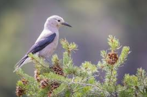
Though our traditional week was the last week of August when the Berkeley Hills were the foggiest, we visited twice at other times for a day. Once was in June – spring in the Sierra when the meadows were wet and green and birds sang everywhere. Angora was transformed by robin song. By late summer, we were left with the harsh voices of Steller’s Jays and the chatter of squirrels and chipmunks. Toward the end of our stay, Clark’s Nutcrackers called as they began moving down from the higher mountains ahead of winter.
Probably the strangest visit to Angora was the first day of the new year before the arrival of the winter snows. The lake before us was frozen and the sun was about to set behind Echo Peak. Once the sun disappeared, we were cold. But what detained us was a deep growling sound coming from across the lake near the cliffs. What was that? Bear, mountain lion? Feeling unwelcome in this unfamiliar Angora, we hurried down the hill until near the Lookout ridge we regained the sun. Later, we learned we had heard the scrapping of the ice against the cliff. Maybe the sound was distorted and amplified by the ice itself or by the cold, deep water below.

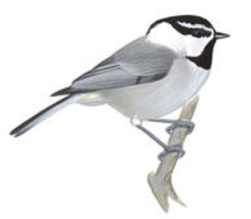
Usually after a few days of being under the lee of the cliff, I was ready for some distant views. Walking down the hill to the pond and the big flat area open to the sky, I could see to the south the familiar shapes of the peaks around Carson Pass. The tall Jeffrey Pines are widely spaced. From the upper branches came the clear, three notes of the Mountain chickadee and the somnolent buzzy song of the Western pewee which always made me drowsy on warm Sierra afternoons.
I headed back up the hill for a nap.
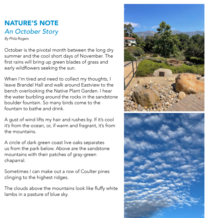
On those days when my mind gets stuck on negative thoughts, I leave my apartment and walk down to the Native Plant Garden. Sitting on the bench, I listen to the soft gurgle of the water flowing out of the top of the sandstone boulder, knowing that in a few minutes birds will arrive for a drink or a bath.
My eyes follow the green slope of plants to the far edge of the garden where a row of dark green California Live Oaks separate us from Mission Creek at the bottom of the hill.
This is your land, our land, and the plants that supported the generations who came before us. Oak acorns ground in stone mortars produced the staple food for the Chumash Indians. I look up to the high mountains to the cliffs of sandstone like the rock in front of me and to the areas of gray-green plants many of which grow in our garden. And then the sky, always the sky, and I am deeply comforted by this enduring landscape.
FOLLOW BLOG BY EMAIL
Enter your email address over on the right to follow this blog and receive notifications of new posts by email.
Early November
The resident hawk
Repeats its urgent calls.
Where is the rain?
The temperature is above eighty.
Night falls with red skies
Color caught by the high cirrus clouds
Too thin for rain.
With darkness comes
The cricket stridulations,
The final notes of the fading season
After midnight I step out on my porch,
Looking high to the south.
Orion waits, trailed by Sirius,
The hunter’s faithful dog.
Venus will soon separate itself from the rising sun
And before month’s end will shine alone
In the eastern sky.
Once I’d imagined spending my final years
In the town where I was born
In a tiny house of my own design
One room only
With alcoves for bathing, sleeping, fixing tea
A steep roof with a skylight or two
A generous porch under a sheltering eave
High in the Berkeley Hills,
But instead, my final years
Will be spent in Santa Barbara
in a spacious apartment
One of many apartments
For elders like myself,
Close to family,
a hedge against loneliness.
The geographer in me
Wants to tell you
That Santa Barbara is located
At the southern end of central California.
Maybe 50 miles below Pt Conception
Where the coast bends inland
Thanks to the San Andreas Fault
Flexing its muscles.
So now the coastal mountains run
From east to west,
and most confusing of all
You look south if you want to see the ocean.
For me, the ocean has always been to the west,
And the direction of the setting sun
Where if you sail far enough
You’ll bump into China.
The high Santa Ynez Mountains to the North
shield the town from certain cold draughts.
But in downpours, the mountains
Shed all manner of debris
From silt to sandstone boulders
As big as cars.
Now as an amateur geologist,
I’ll tell you that this knoll
I call home, is surrounded
By flatter land referred to
As an alluvial fan,
Crossed by creeks that
Only show up when it rains.
Locals brag about the mild climate
Forgetting about those vehement moments
Of gale-force winds
Called sundowners.
Or what about the microbursts
Which have been known to knock a plane
Out of the sky?
And there’s nothing mild about my landscape.
Never still — it twists, heaves and cracks.
Worse, it is said that all the commotion
Is bringing Los Angeles ever closer.
Once we were covered by a warm sea
With dinosaurs wandering the shallows.
Later mountains rose up,
Full of seashells.
Now it seems that our future is drought.
I look out the east-facing windows
Down into Oak Park with its
Pale limbed-sycamores and faded foliage.
It’s a peoples’ park
With mariachis on the weekend
Shouting children,
Birthdays with piñatas
Quinceaneras, sometimes a funeral
Look up to the first ridge
To St. Anthony’s towers
And to the two rosy domes
Of the old mission.
Higher yet is the bulk
Of the Santa Ynez mountains
and the conical shape
Of my mountain – Montecito Peak
See how the angled sun
Deepens the canyons.
Slide your eyes sideways
To where the mountains
Slip into the blue line of the sea.
Now face south
Over our native garden
Bordered oaks from the park
To the silent creek bed.
I look for hummingbirds, bush rabbits
and worry about coyotes
The east hills, called the Mesa
Holds off the fog
Until after dark,
when the hills are breached.
Oh yes, my garden off the front door
The narrow porch of a garden,
Hung with red geraniums
And softened by pots of ferns
I lie in my bed beneath the windows
Hoping for wind to move the chimes.
I lift my head at dawn.
Do I see the silhouette of the mountains
Against the lightening sky?
Or are we cocooned in the fog
That drips from trees
Almost as welcome as rain.
And what is the first bird this morning?
The clink of the towhee
The querulous wren
The sweet ring of sparrows’ song?
Now you are hearing the voice of the birder
Leaning on every song
In the absence of good eyesight.
Acorn woodpecker, flicker
With strong beak and loud call,
Or the relentless caw of the black crow,
Boss of the neighborhood?
Will I be lucky enough
To have an owl’s hoot rouse me
In the early morning hour?
I feather my nest
With a down comforter
Books,
Bouquets of pungent sage,
Baskets of lichen.
How do I finish this short tale?
A day ending, I suppose.
With the dark coming on by five
A tale of rain arriving?
A gusty wind from the southeast
Testing itself.
In the early morning hours
Between midnight and dawn
The rain falls
I smell it first
And then sweet fragrance of hope
Could this be
The beginning of a season
Of abundant rains
Enough to end the drought?
COMING IN THE SPRING: The Best for Last: The Nature of Santa Barbara by Phila Rogers. Includes the blogs and a number of short pieces.