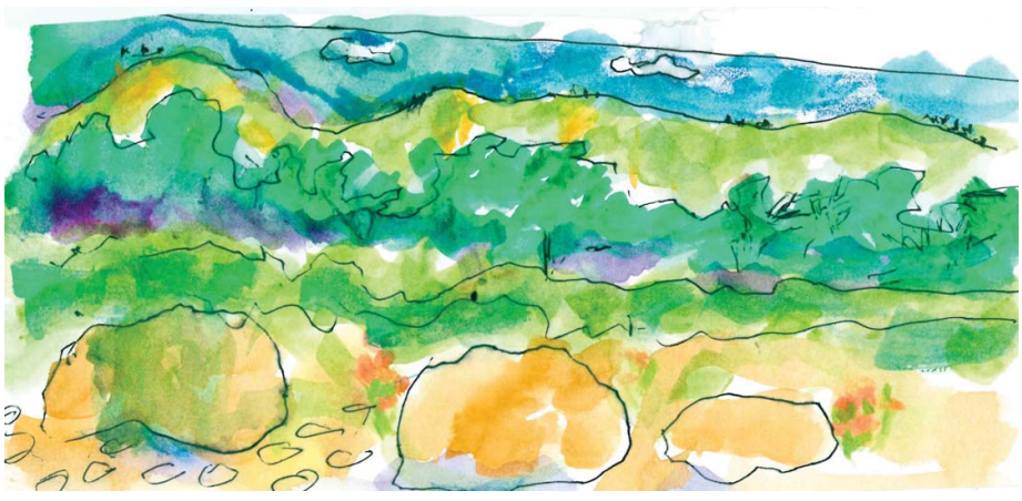
This is one of the noteworthy days of the year, the fall equinox and the first day of fall. Like the spring equinox six months from now, day and night are roughly equal in length. The Bewick’s Wren is singing a more joyous song and the Oak Titmouse sings a combination of their spring halleluiahs with their raspy call notes. Nothing will come of it, of course, and the days will continue to grow shorter by two minutes a day until we are jolted by darkness falling by 7 PM.
In Santa Barbara on the south coast, a 100 miles west northwest of Los Angeles, fall doesn’t really show up until October, when the California grapevine turns red on the fence and the winter birds show up in the coastal gardens.
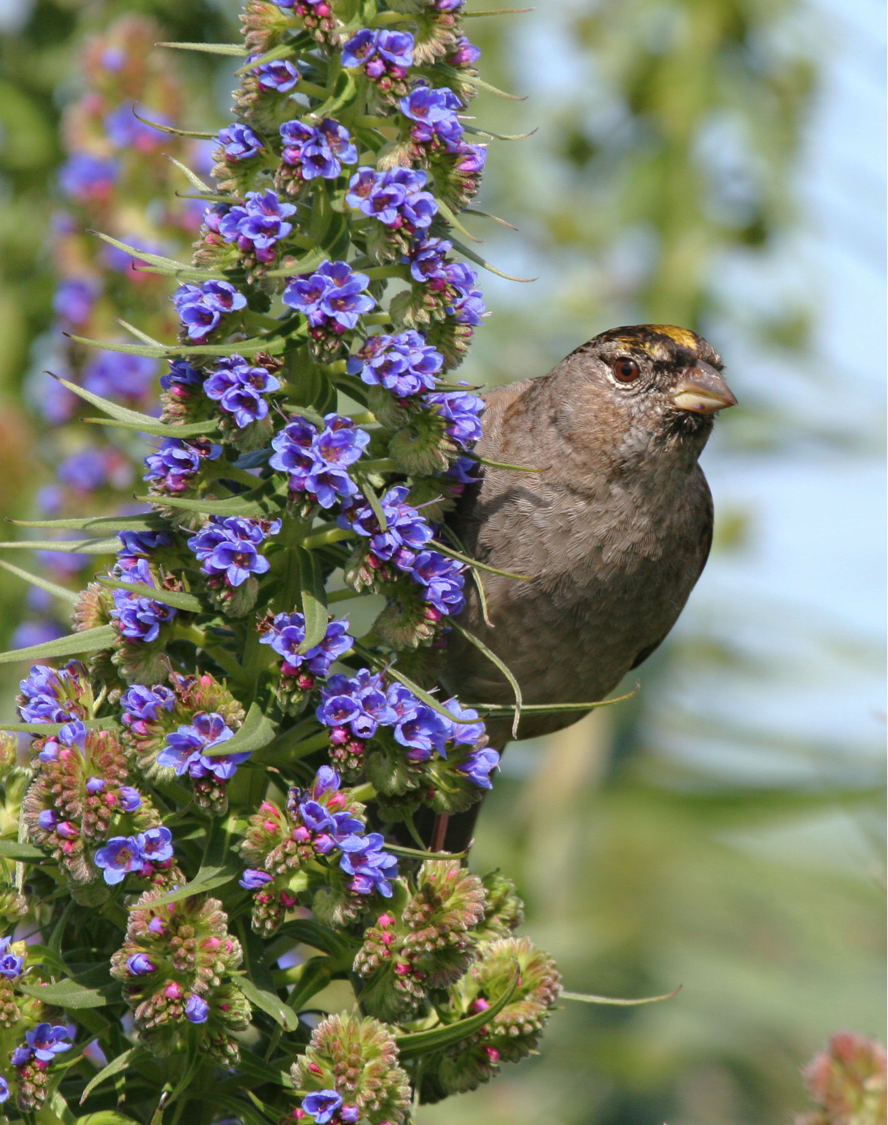
Golden-crowned Sparrow
Over the last few days, Bay Area birders are plucking my heart strings by reporting the first Golden-crowned Sparrows of the season. I remember those chilly mornings in the Berkeley Hills when I would walk up the street towards the pasture whistling their song. If they had arrived in the early morning hours after a long night’s flight, they answered me with one or two minor key notes. I would yelp with joy and dance a quick jig. When I returned home, I made an entry in my notebook, circling the date in red.
It would be a few more days before the little flocks worked their way into the neighborhood to settle into their winter territories. I wondered if these birds were the ones that had come last year and maybe several years before. The good news was that they remained until mid or late April, developing the bright yellow crown, before departing for the far north. During the winter you could count on them singing just before it started to rain.
As far as I know there are no golden crowns in this neighborhood or even in Oak Park. They are most often reported in weedy fields in open areas like the upper Elings Park.
A single mature male has spent the summer feeding with several Song Sparrows in a clearing near Los Carneros Lake. Apparently, it declined to join the others of its kind for the migration north in April. Was he damaged in some way or simply lacked the normal instinct, the irresistible urge to migrate?
Hearing the Western Tanagers on the move, I will start listening for our winter birds, though I know it’s probably too early. I arrived at Samarkand as a reluctant migrant from Northern California at this time nine years ago. It was during the lull between the seasons. I was disconsolate. I looked for one familiar bird. Finally, there it was — a California Towhee scratching in the leaves alongside the pathway.
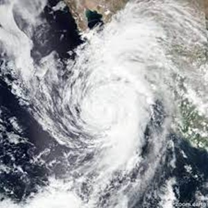
Satellite image of Hurricane Kay
Something did arrive early this year, a substantial rain but with hardly a sprinkle here. Elsewhere, it was enough to signal the annual nuptial flight of the termites when some of these subterranean creatures grow a pair of gossamer wings for a day’s fling above ground in the bright air. The queen ascends high in the sky pursued by ardent males eager to mate with her. Then as quickly as it began, it was all over and the termites resumed their lives in the dark with a pregnant queen, leaving behind a shimmering carpet of discarded wings.
Credit: Sylvia Casberg
I had assumed this early storm was like the ones to follow, moving down the coast from the north. But the cause was Hurricane Kay, an extensive, well-organized storm which had originated off the coast of Baja California, slowly weakening as it moved north to bring varying amounts of rain.
Nature sent us a consolation prize though — a double rainbow which felt more like a gateway to grander things.
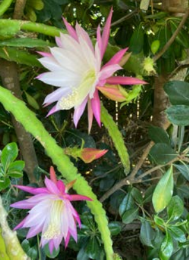
Nancy Keele lives in one of the cottages referred to as a Southview villa. Unlike most residents at Samarkand who have either a balcony or a small patio, Nancy has both a small front yard and a rear garden which includes a handsome Canary Island Date Palm where she raises her Epiphyllums.
As told to Phila Rogers (SamNews September 2022)
When I look out into my beautiful gardens, I can’t help but think of my mom, and her influences on my life. She gave me my first two Epiphyllums (“Epies”) and put me on my first pony. As I grew older, to help me develop talents, she agreed to take me horseback riding monthly if I practiced the piano daily.
As an adult I fell in love with the Epies; my collection numbering above 100 before my move to The Samarkand.
Mystic Mood
I fulfilled my dream of having a horse by owning a 13-acre ranch on San Marcos Pass where I bred, raised, and trained Arabian horses. I exhibited in many shows throughout California.
I was the Choral Music director at Santa Barbara Junior High, and at La Colina Junior High School, where I was also involved with Music Theatre productions.
My front walkway garden is lined with Epidendrums, Cymbidiums, and succulents. However, the Epiphyllum “stars” are in my back patio garden. In nature they grow in trees; I grow them in nursery pots. Blooming season is in the spring (March through June).
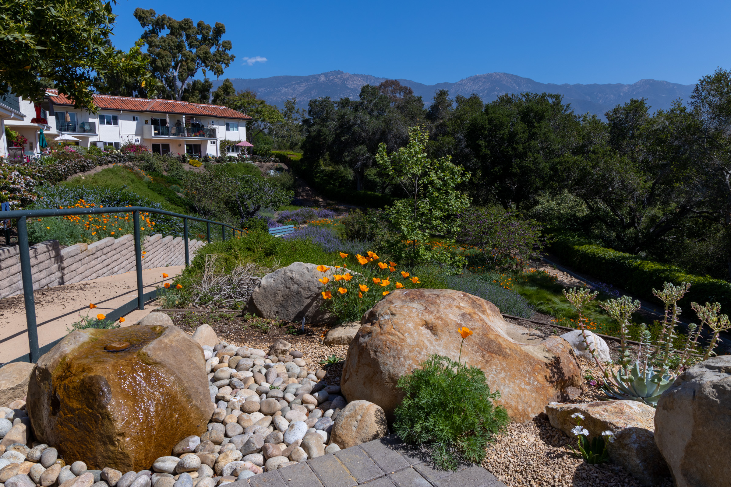
On those days when my mind gets stuck on negative thoughts, I leave my apartment and walk down to the Native Plant Garden. Sitting on the bench, I listen to the soft gurgle of the water flowing out of the top of the sandstone boulder, knowing that in a few minutes birds will arrive for a drink or a bath.
My eyes follow the green slope of plants to the far edge of the garden where a row of dark green California Live Oaks separate us from Mission Creek at the bottom of the hill.
This is your land, our land, and the plants that supported the generations who came before us. Oak acorns ground in stone mortars produced the staple food for the Chumash Indians. I look up to the high mountains to the cliffs of sandstone like the rock in front of me and to the areas of gray-green plants many of which grow in our garden. And then the sky, always the sky, and I am deeply comforted by this enduring landscape.
FOLLOW BLOG BY EMAIL
Enter your email address over on the right to follow this blog and receive notifications of new posts by email.
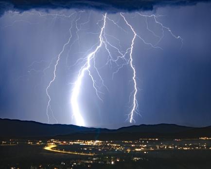
When webmaster George Dumas pushed the button to publish “Summer Doldrums,” I suggested that we take a month off as nothing much was going to happen during the summer months. Then, on the morning of June 24 I woke to a day that both felt and looked different. Cumulus clouds were heaped up against the backside of the Santa Ynez mountains and flotillas of small white clouds with lacy edges stretched across the sky. Listening to my weather radio, I learned that a monsoon brought violent storms to the Los Angeles basin and the surrounding mountains.
Monsoon season most often occurs in July and August and brings most of the annual rainfall to the Southwest. We were experiencing the edge of the first one today.
Lightning over Los Angeles
Most monsoons occur when the hot summer sun heats up the land and the wind shifts to the south drawing up the moist, unstable air from the Gulf of California or the Gulf of Mexico.
Along with rain came strong wind gusts and even some hail in Los Angeles. The electrical storms produced an estimated 3,600 lighting strikes, one igniting a brush fire in the Tehachapi and another tragically striking and killing a woman and her two dogs who were taking a morning walk along the San Gabriel riverbed. Fatal lightning strikes are rare with this being the first one of some 20 occurring each year.
Asphalt struck by lightning
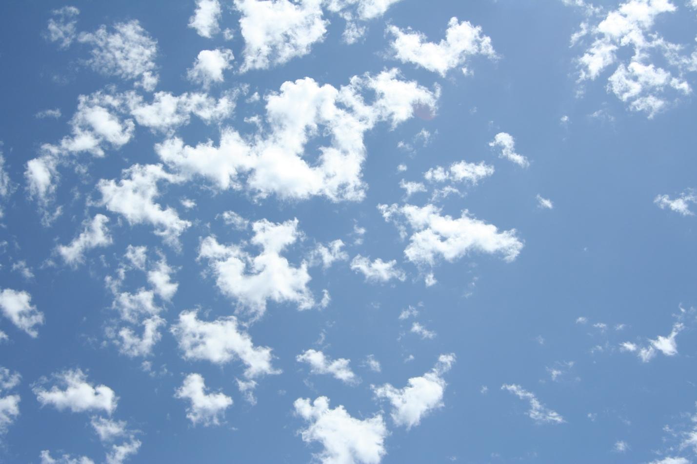
Only the northern edge of the monsoon reached Santa Barbara. I spent the day outside with my camera, my eyes always on the sky. The air was silken, not too humid without any of that sharpness we associate with the typical onshore flow from the ocean. It was the kind of day that makes you feel like a different person.
Lingering monsoon clouds over Santa Barbara
Now, at almost 4 PM, the show is mostly over. The heaps of clouds over the highest mountain ridges have withdrawn or simply melted away leaving behind a few cloud fragments.
Although failing to bring us rain, the monsoonal visit was a delightful change from the usual coastal weather.
SUMMER SOLSTICE
The rising solstice sun shines behind the ancient entrance of Stonehedge and the rays of the sunlight shine into the center of the monument.
It’s been several weeks since the Summer Solstice, but the days grow shorter so slowly at first that you’re not apt to notice. Because of the earth’s tilt toward the sun, the sun is directly over the Tropic of Cancer at a latitude of 23.5 degrees north. The Tropic of Cancer passes over Baja California as it circles the globe, or more precisely, over the small seaside town of Todos Santos, an hour’s drive north of Cabo San Lucas where a planted stick casts no shadow.
Because of the slow heating of the land by the sun, the highest temperatures will be several weeks later in mid-July.
Within the Arctic Circle, at the Summer Solstice, the sun will shine for 24 hours while darkness will prevail at the south pole.
Me and my short shadow at high noon. Samarkand, Santa Barbara (34.006 degrees north) [Photo by Jodi Turley]
Over the millennia, various cultures have celebrated the Summer Solstice in different ways. Here in Santa Barbara we have a parade with imaginative handcrafted floats, bands (emphasis on drums ) and costumed dancers moving to the beat. For me, butterfly wings glowing in the sunlight epitomizes summer.
FOLLOW BLOG BY EMAIL
Enter your email address over on the right to follow this blog and receive notifications of new posts by email.
June’s entry is an expansion of my monthly column (“Nature’s Note”) in “Sam News,” our in-house publication.
Morning fog out of my window
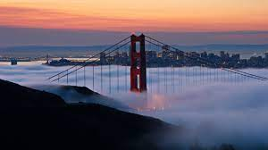
Space is always limited while my blogs are as long as my loyal webmaster, George Dumas, has the time and patience for converting my words into the WordPress format. It’s no secret that I am no fan of fog. But now with my declining eyesight, my world is enveloped in a perpetual haze and on foggy mornings we’re all in it together.
It’s only on the clear days that I know how much I’m missing. But at 93, I am every day grateful for a good mind and the ability to express and feel gratitude for what I still have.
It is through song and call note that I now recognize most birds. And I’m helped along by general body shape, where and how they are feeding and whether they prefer the ground or trees.
Even without my disability, it behooves me even if I don’t love fog, to at least learn to appreciate it by understanding how fog is formed and its likely behavior.
FOGGY DAYS
Today is June 1st. We are halfway between the two foggiest months of the year which locals call May Gray and June Gloom. When the prevailing northwest winds pass over the even colder ocean, the air condenses into tiny droplets producing the fog.
But it’s not as simple as that. In the northern hemisphere, the earth rotates counterclockwise (the opposite in the southern hemisphere). Because of this rotation, wind blowing from the northwest (our prevailing summer wind) curves to the right. As the wind curves to the right, it sweeps off the top layer of water causing the upwelling of the deep, colder water. When the relatively warmer wind passes over the cold, upwelled water, fog is formed.
Upwelling of deep ocean water
This rotation, called the Coriolis Effect, has a profound effect on tides, bodies of air and even the behavior of storms. It causes our rainstorms moving in from the Pacific to rotate counterclockwise, so that the winds of an approaching storm, blow from the south.
Depending on the topography, fog can put on a dramatic show. In the Bay Area, fog building up like waves over the Sausalito Hills spills over the lee slopes. Unimpeded, fog moves like a river through the Golden Gates, the only complete break in the coastal hills. To the north and south the fog seeks out gaps in the hills as it moves inland.
Fog pouring through the golden gate
When the fog enters the Bay through the Golden Gate part of of it aims for the Berkeley Hills. The rest turns left drawn irresistibly toward the heat and low pressure over the Delta and the Sacramento Valley. The fog is often accompanied by strong cold winds that are notorious in summer afternoons rushing through the canyons of tall buildings in San Francisco.
Fog moving into Santa Barbara at sunset
And there were those mornings in Berkeley when the fog stayed low and my hill rose above it like an island in a gray sea.
The fog varies in its extent. It can spread far out to sea. It can be a narrow ruffle covering just the beach or it can be drawn far inland by the warmer temperatures. It may flow at night into coastal valleys, and in foggier periods it will surmount coastal ranges, visiting even inland valleys.
Most days the fog will retreat offshore by midday, but other times the marine layer persists for days on end seriously depressing the spirits.
Fog drip
Meteorologists call this cloud type status. It’s usually made up of rather smooth layers of clouds that can sometimes meet the ground. The fog can either be “dry” or it can produce drizzle especially under trees, enough to register in a rain gauge. We need any moisture in this semi-arid climate of ours where longer periods of drought are a part of climate change.
Even though I seem to thrive on those days which begin with sun, I am now gratified, while still in bed on a windless dawn to hear the drip, drip of condensed fog falling off leaves and needles.
FOLLOW BLOG VIA EMAIL
Enter your email address over on the right to follow this blog and receive notifications of new posts by email.
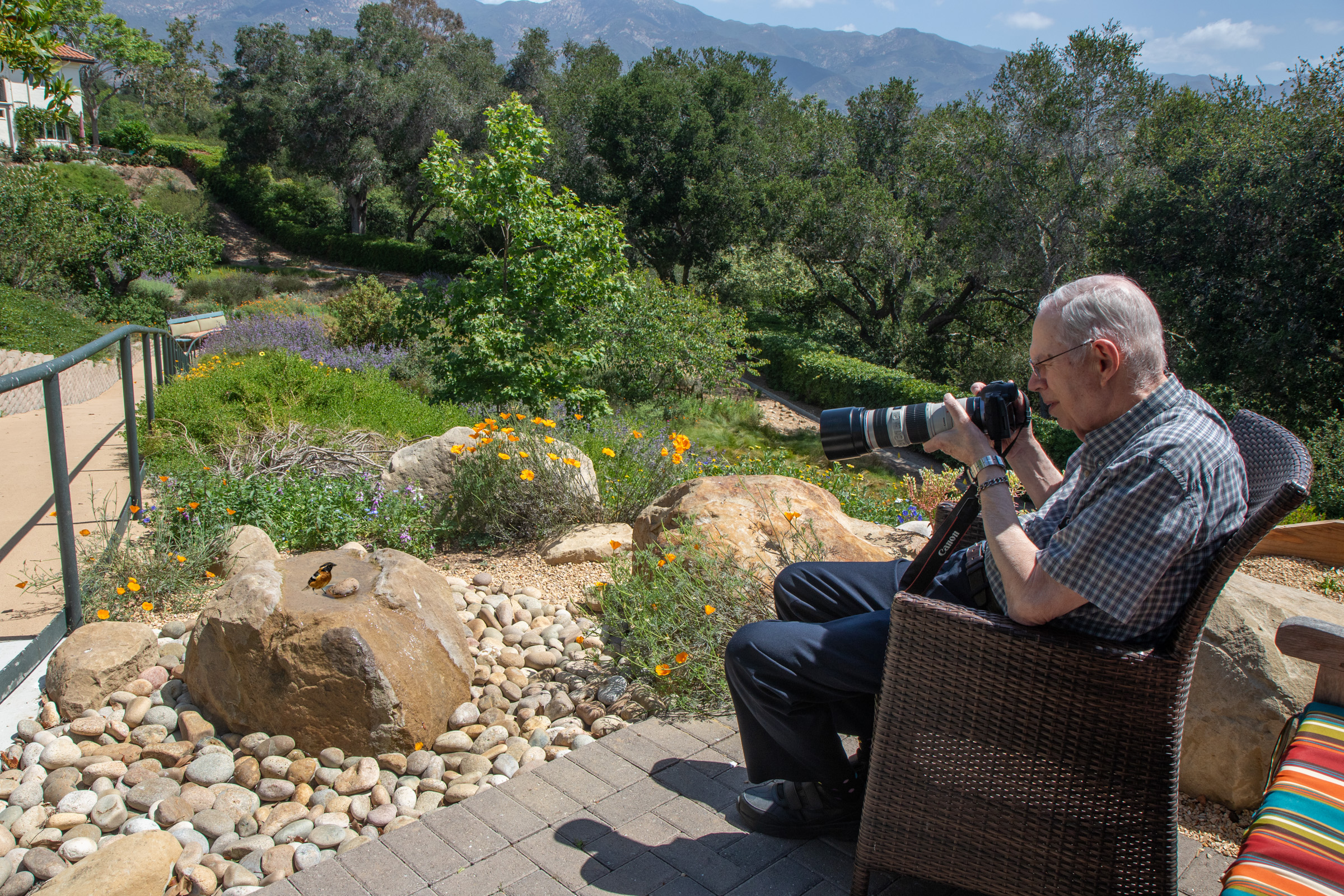
Tom Ginn and his wife Sherry moved into Samarkand in July 2011 from Los Gatos, a leafy residential community south of San Francisco. Before retiring Tom had worked as a software engineer. He was already a serious amateur photographer using a top-of-the-line Canon.
Along with recording the life of the family, including a son and daughter, he was also adding landscapes to his collection. “I haven’t shot a roll of film since 2003; digital photography and the computer give me so much more versatility,” he says.
But those who know Tom appreciate his outstanding patience as he waits for just the right shot to produce a memorable portrait of an elusive insect, a butterfly with its erratic flight or a shy bird as it comes to the bird bath.
The first bird photos were taken over several months at the bird baths behind Ann and Bob Allen’s duplex, located over the fence at the southernmost end of the EastView apartments. The duplex, Oakcrest, has the ideal birding location, sheltered by oaks up the steep slope of Oak Park.
The birds are drawn to the area by Mission Creek and its forest of sycamores and Coast Live Oaks. Ann has arranged a welcoming collection of shallow pot bottoms filled with water, surrounded by mostly potted native plants. When it’s hard to find a good variety of birds elsewhere at the Samarkand, you can count on being rewarded at Ann’s bird baths.
When a large sandstone boulder (over the fence at the top of the Native Plant Garden) became a bubbling bird bath, the birds had a second choice for their drinks and baths. The first group of photos is in Ann’s garden, and the second larger group is at the “Bubbling Fountain.”
The birds are identified by species accompanied by a few comments. Some of the photographs have been made into greeting cards and can be purchased at the Samarkand gift shop.
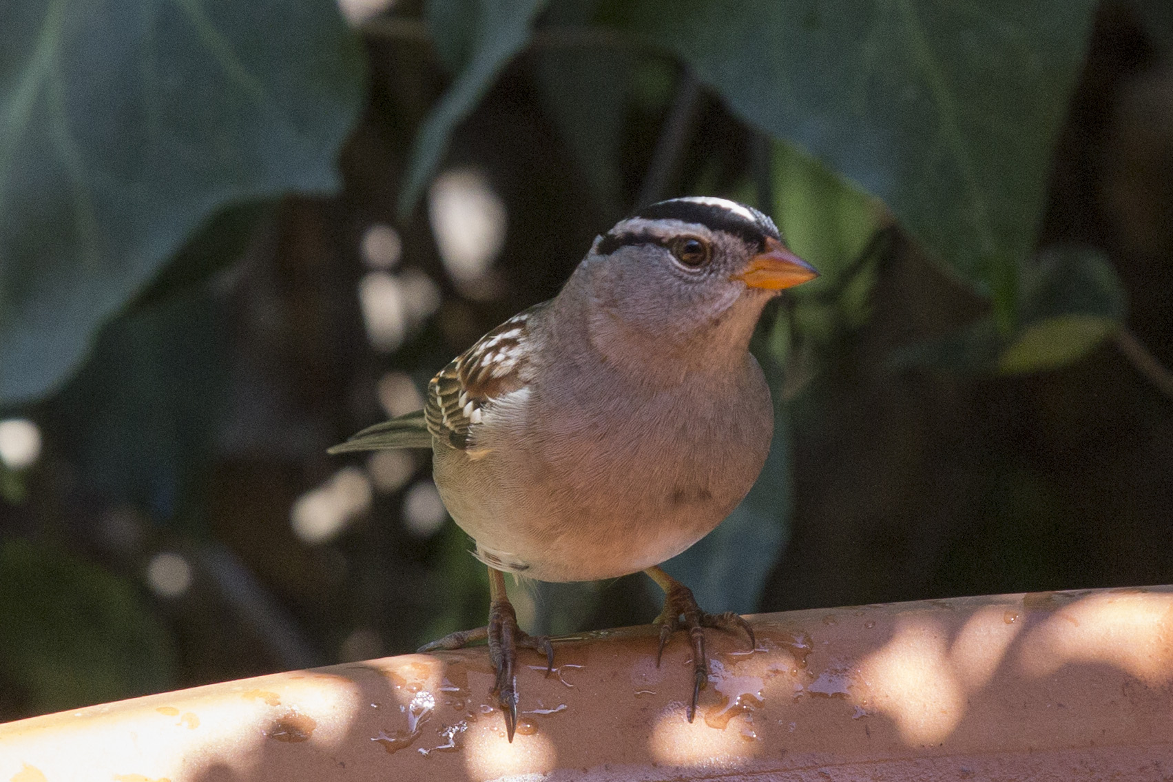
(1) White-crowned Sparrow. A group of these sparrows spend the winter in the Native Plant Garden often singing.
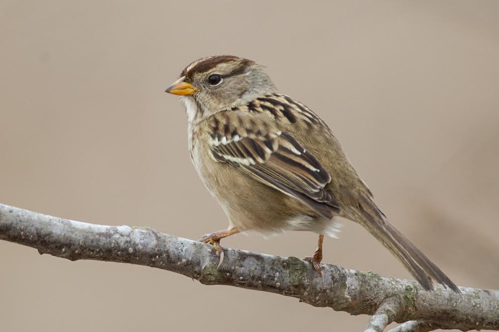
(2) Immature White-rowned Sparrow. In April the group flies to Northern Alaska where they nest in the dwarf willows before returning to our garden in October.
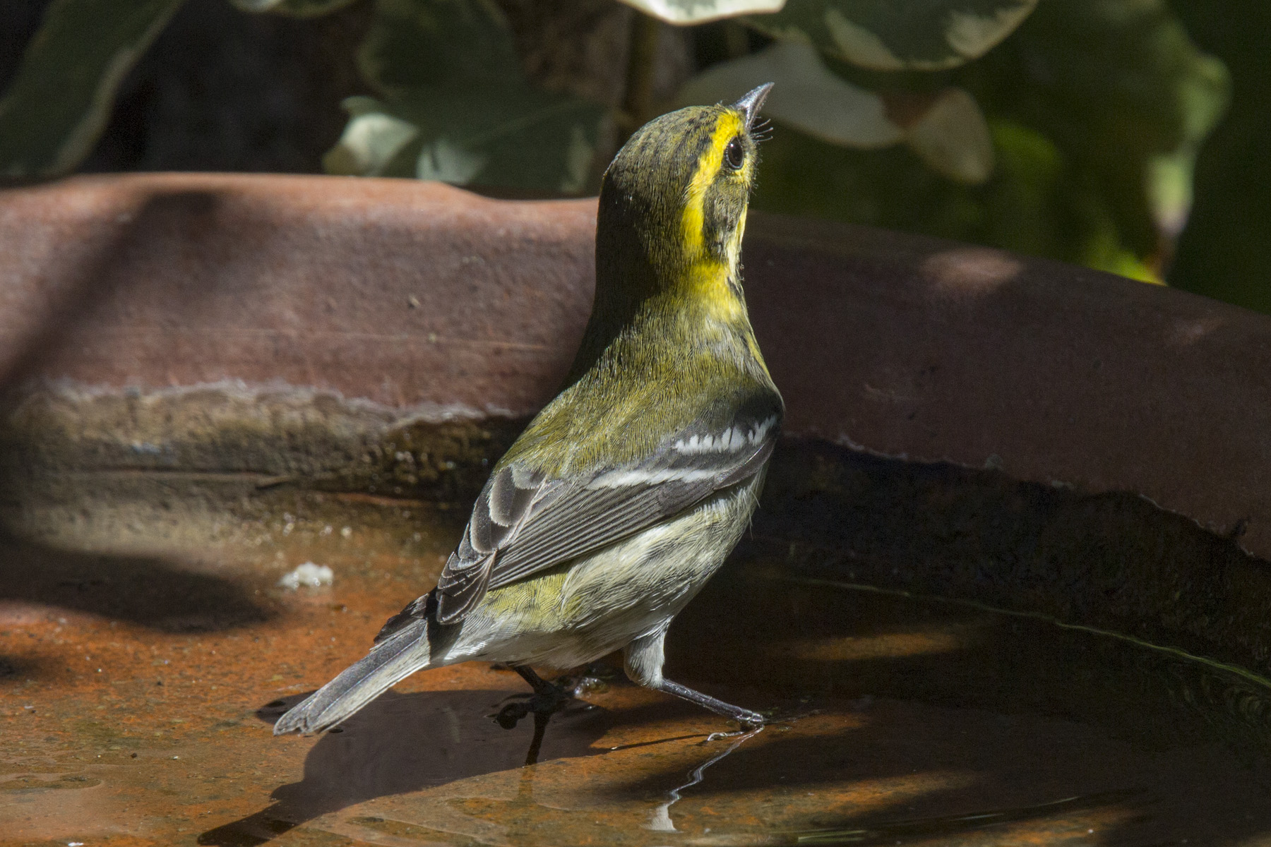
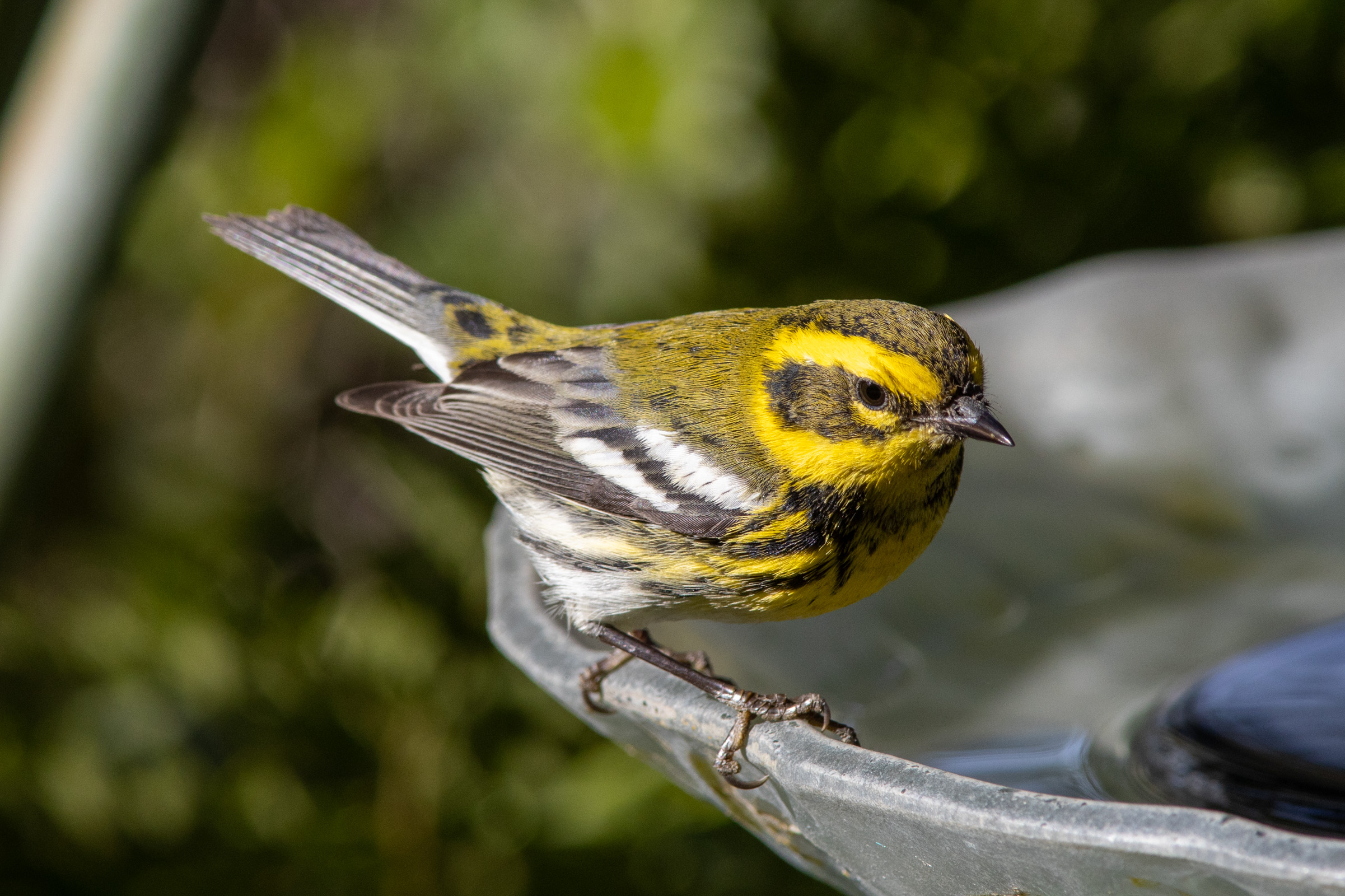
(3)(4) Townsend’ s Warbler. Another winter bird with especially bright plumage.
(5) Orange-crowned Warbler. Year-round bird.
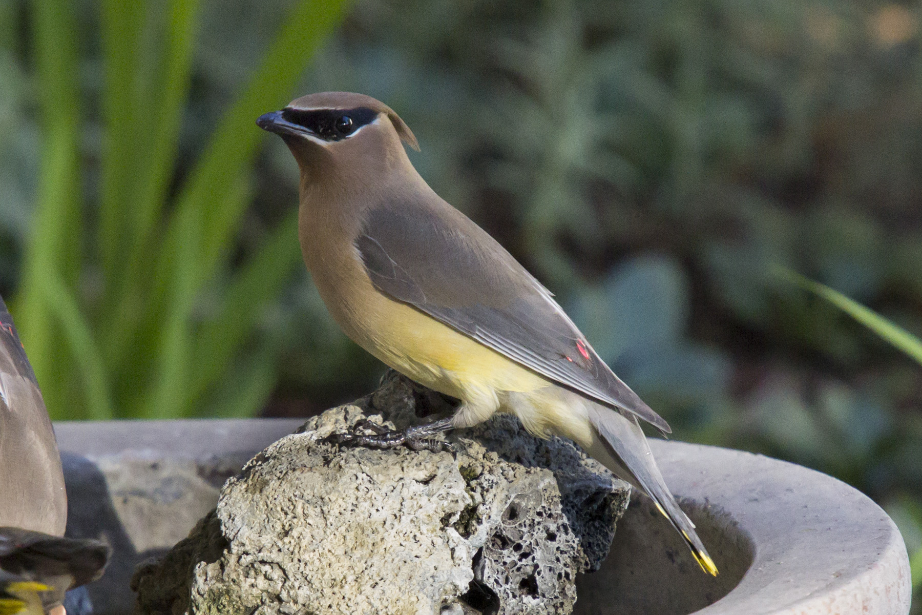
(6) Cedar Waxwing. This lovely bird is a nomad traveling in flocks from place to place in search of berries. They are sometimes in the company of Robins.
(7) Group of Cedar Waxwings. In the spring they will head north to conifer forests where they will briefly breed before heading back on the road again.
(8) Nashville Warbler. An uncommon visitor.
(9) Ruby-crowned Kinglet. A small, energetic bird who reveals his bright crown when agitated. He is another of our winter residents
(10) California Towhee. A big sparrow who is a year-round resident.
(11) Yellow-rumped Warbler. Developing its breeding plumage before heading north.
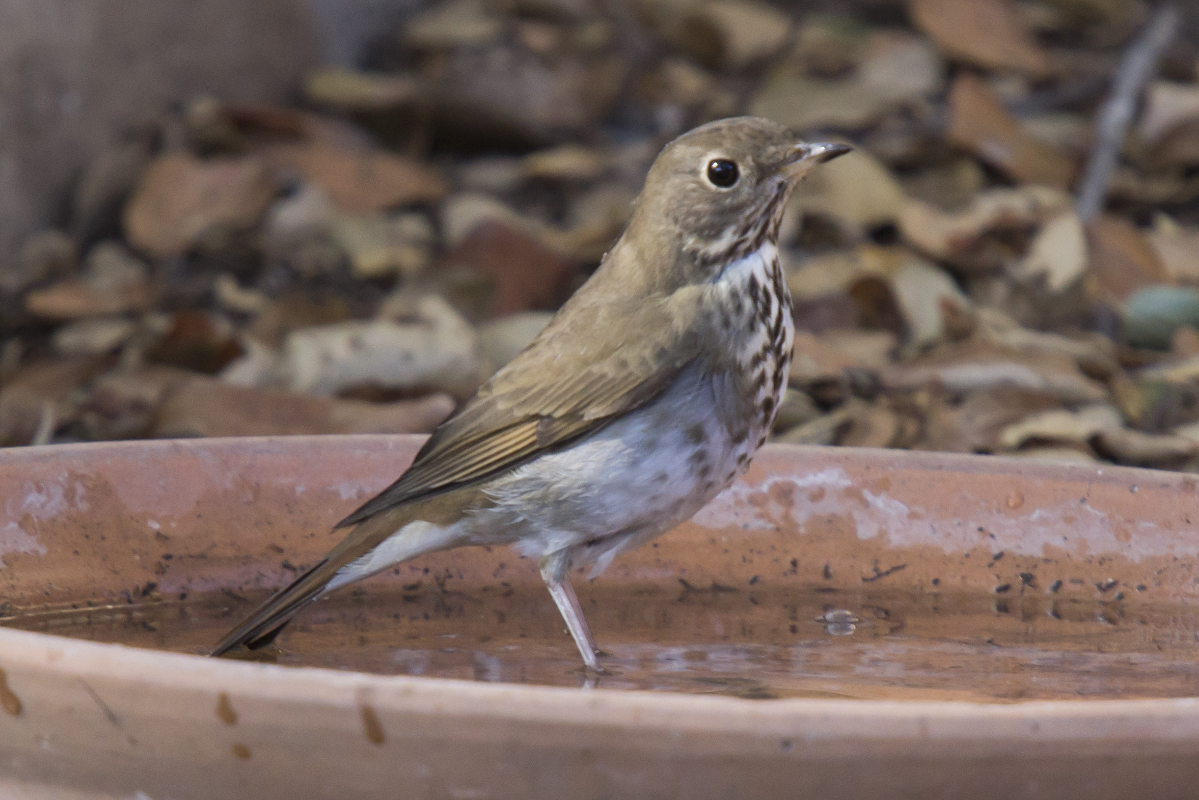
(12) Hermit Thrush Another winter resident who heads for the Sierra in the spring to sing its glorious song.
The sandstone fountain, we call “Bubbling Rock” in the foreground overlooks the Native Plant Garden.
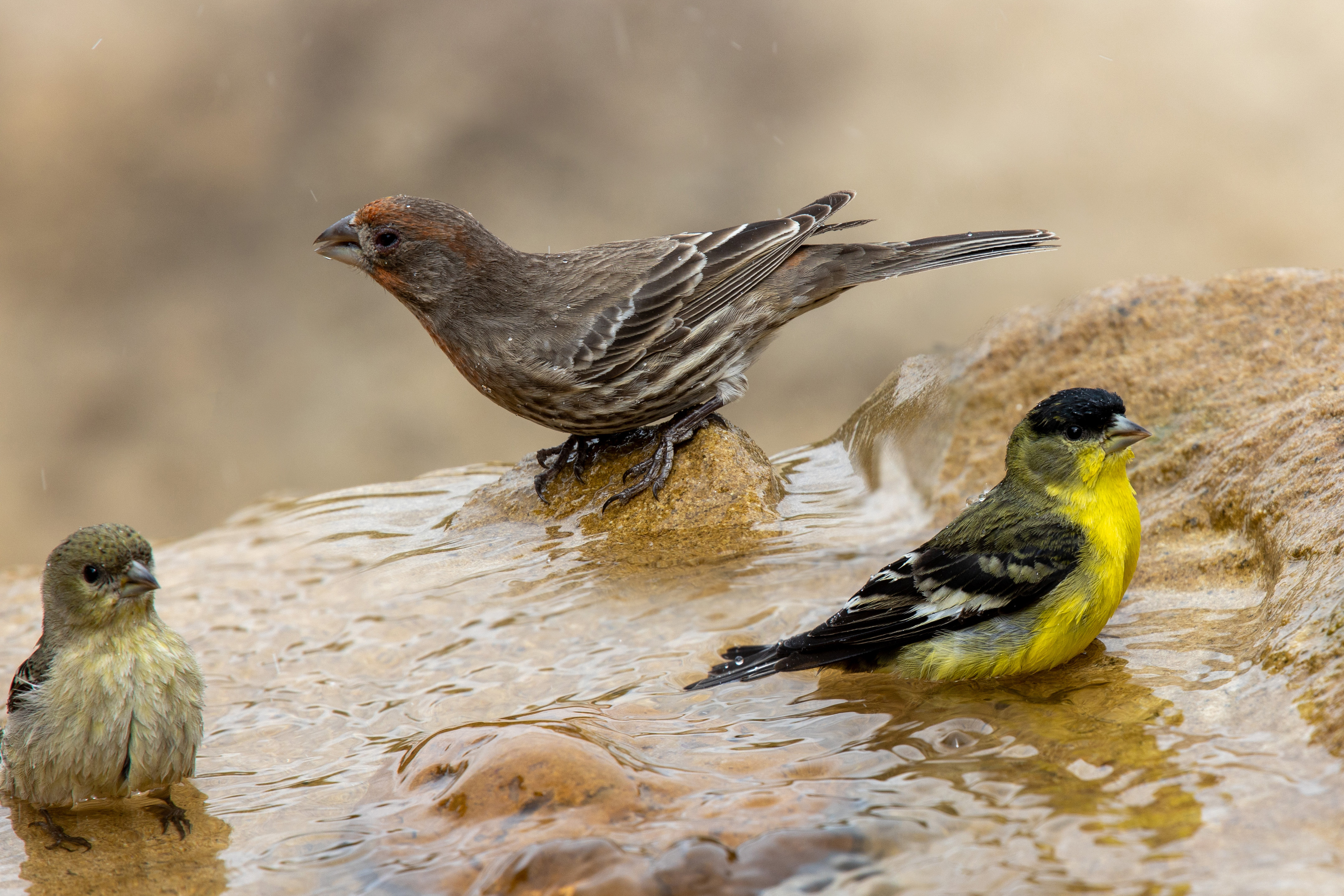
Anna’s Hummingbird on approach (1)Male Lesser Goldfinch (2)various goldfinches (3)Orange-crowned Warbler (4)Male Dark-eyed Junco (5)Male House Finch (L) & Pine Siskin (6)California Scrub Jay takes a serious bath (7)Orange-crowned Warbler (8)Oak Titmouse (9)Male Lesser Goldfinch (10)Allen’s or Rufous Hummingbird (11)Four Nutmeg Mannikins (12)Tom Ginn (13)
(1) The Anna’s Hummingbird is a year-round resident and the largest of our local species.
(2) & (3) Adult, female, and immature Lesser Goldfinches.
(4) Orange-crowned Warbler. Several breeding pairs sing almost continuously above Oak Park at Samarkand in the spring.
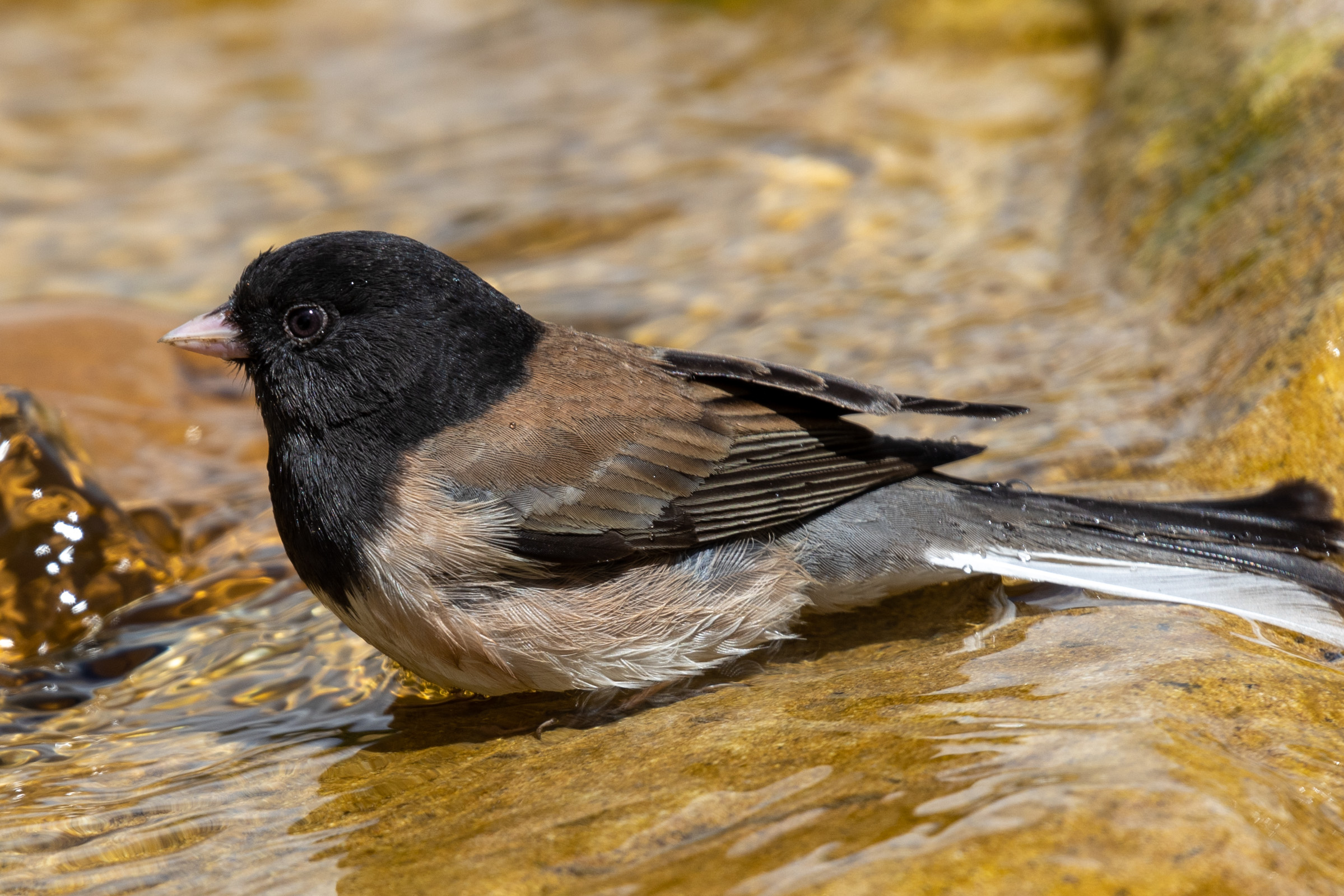
(5) Male Dark-eyed Junco. Juncos, who nest on or near the ground, are one of our most abundant species.
(6) Male House finch(L) and Pine Siskin appear to be comparing stripes.
(7) Like the crows, jays are members of the Covid family with similar aggressive ways.
(8) A wet Orange-crowned Warbler revealing its orange crown feathers.
(9) A titmouse will occasionally build a nest in a bird box.
(10) Male Lesser Goldfinch, one of the most abundant year-round birds.
(11) Probably an Allen’s Hummingbird or possibly a migrating Rufous Hummingbird.
(12) Four Nutmeg Mannikins. They are escaped cage birds which have successfully naturalized.
(13) Tom Ginn photographing at “Bubbling Rock”
Tom’s Camera: Canon EOS R with a 70-200mm f4 lens and 1.4x extender
Early November The resident hawk Repeats its urgent calls. Where is the rain? The temperature is above eighty. Night falls with red skies Color caught by the high cirrus clouds Too thin for rain.
With darkness comes The cricket stridulations, The final notes of the fading season
After midnight I step out on my porch, Looking high to the south. Orion waits, trailed by Sirius, The hunter’s faithful dog.
Venus will soon separate itself from the rising sun And before month’s end will shine alone In the eastern sky.
Once I’d imagined spending my final years In the town where I was born In a tiny house of my own design One room only With alcoves for bathing, sleeping, fixing tea A steep roof with a skylight or two A generous porch under a sheltering eave High in the Berkeley Hills,
But instead, my final years Will be spent in Santa Barbara in a spacious apartment One of many apartments For elders like myself, Close to family, a hedge against loneliness.
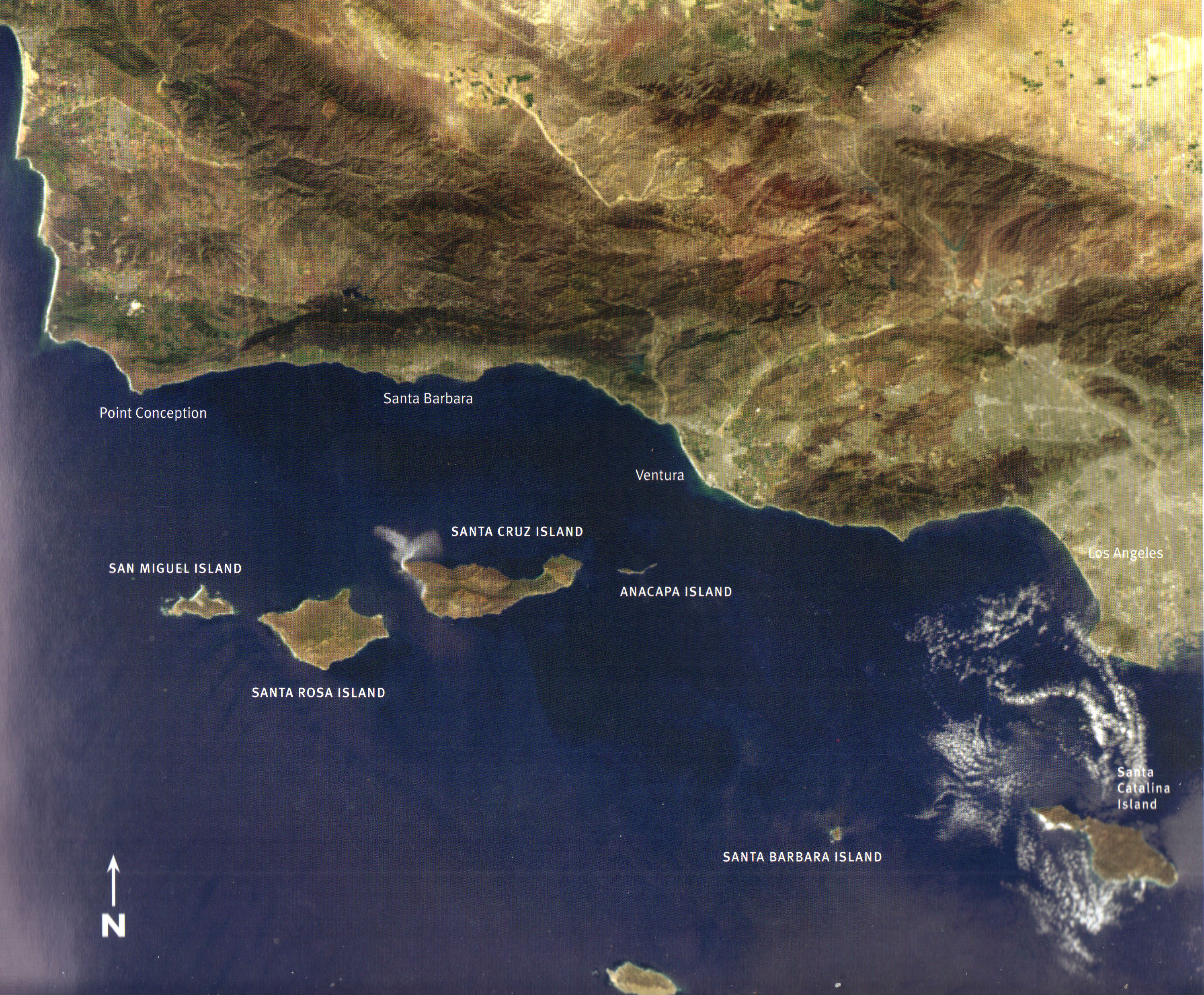
The geographer in me Wants to tell you That Santa Barbara is located At the southern end of central California. Maybe 50 miles below Pt Conception Where the coast bends inland Thanks to the San Andreas Fault Flexing its muscles. So now the coastal mountains run From east to west, and most confusing of all You look south if you want to see the ocean.
For me, the ocean has always been to the west, And the direction of the setting sun Where if you sail far enough You’ll bump into China.
The high Santa Ynez Mountains to the North shield the town from certain cold draughts. But in downpours, the mountains Shed all manner of debris From silt to sandstone boulders As big as cars.
Now as an amateur geologist, I’ll tell you that this knoll I call home, is surrounded By flatter land referred to As an alluvial fan, Crossed by creeks that Only show up when it rains.
Locals brag about the mild climate Forgetting about those vehement moments Of gale-force winds Called sundowners. Or what about the microbursts Which have been known to knock a plane Out of the sky?
And there’s nothing mild about my landscape. Never still — it twists, heaves and cracks. Worse, it is said that all the commotion Is bringing Los Angeles ever closer.
Once we were covered by a warm sea With dinosaurs wandering the shallows. Later mountains rose up, Full of seashells.
Now it seems that our future is drought.
I look out the east-facing windows Down into Oak Park with its Pale limbed-sycamores and faded foliage.
It’s a peoples’ park With mariachis on the weekend Shouting children, Birthdays with piñatas Quinceaneras, sometimes a funeral
Look up to the first ridge To St. Anthony’s towers And to the two rosy domes Of the old mission.
Higher yet is the bulk Of the Santa Ynez mountains and the conical shape Of my mountain – Montecito Peak See how the angled sun Deepens the canyons.
Slide your eyes sideways To where the mountains Slip into the blue line of the sea.
Now face south Over our native garden Bordered oaks from the park To the silent creek bed. I look for hummingbirds, bush rabbits and worry about coyotes
The east hills, called the Mesa Holds off the fog Until after dark, when the hills are breached.
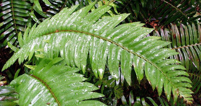
Oh yes, my garden off the front door The narrow porch of a garden, Hung with red geraniums And softened by pots of ferns
I lie in my bed beneath the windows Hoping for wind to move the chimes. I lift my head at dawn. Do I see the silhouette of the mountains Against the lightening sky?
Or are we cocooned in the fog That drips from trees Almost as welcome as rain.
And what is the first bird this morning? The clink of the towhee The querulous wren The sweet ring of sparrows’ song?
Now you are hearing the voice of the birder Leaning on every song In the absence of good eyesight.
Acorn woodpecker, flicker With strong beak and loud call, Or the relentless caw of the black crow, Boss of the neighborhood?
Will I be lucky enough To have an owl’s hoot rouse me In the early morning hour?
I feather my nest With a down comforter Books, Bouquets of pungent sage, Baskets of lichen.
How do I finish this short tale? A day ending, I suppose. With the dark coming on by five A tale of rain arriving?
A gusty wind from the southeast Testing itself.
In the early morning hours Between midnight and dawn The rain falls I smell it first And then sweet fragrance of hope
Could this be The beginning of a season Of abundant rains Enough to end the drought?
This slideshow requires JavaScript.
COMING IN THE SPRING: The Best for Last: The Nature of Santa Barbara by Phila Rogers. Includes the blogs and a number of short pieces.
For the last four years, I have written about Santa Barbara’s seasons, landscapes, and sometimes history. But what has really commanded my imagination during all this time have been the Channel Islands.
On infrequent childhood visits to Santa Barbara during the summer to visit my grandmother’s apartment, two blocks from the beach, or my cousin’s house in the hills, I usually came alone from Oakland on the Southern Pacific Daylight train.
I have no recollection of seeing the islands. Even though mountainous Santa Cruz Island was only 25 miles offshore, it, and its neighboring islands, were usually hidden by a bank of fog.
What I remember most was the beach, the bright city lights from my cousin’s house, the pale flakes of ash that my aunt said were coming from a fire in the mountains.
Satellite View
Not until I was an adult, when two of my three children settled in Santa Barbara, and I often flew south to visit them, did the islands became familiar to me. Most often, the plane approaching the airport made a wide arc over the ocean and the islands so as to land into the prevailing wind from the northwest.
From then on, I was eager to find some way of getting out to the islands. Santa Cruz Island, the largest, was mostly privately owned by the Stanton family of Los Angeles. The second largest island, Santa Rosa Island was owned and operated as a cattle ranch by Vail and Vickers, whose boats sometimes brought cattle to the mainland at Santa Barbara. San Miguel, the northernmost island off Point Conception, a windy place surrounded by a turbulent sea, was famous mostly for its huge population of seals and sea lions, drawn to the cold, upwelled water rich in nutrients.
I remembered from the family stories that both my mother and father as children had visited Santa Cruz Island. Before she died in 1981, I asked my mother to tell me her story.
On lined yellow paper, she wrote in her spidery hand: “When I was a small girl the trip to the Santa Barbara islands was a great adventure. One time my mother, grandmother and little brother went to Santa Cruz Island in a fishing boat. As The Channel was very rough that day, the deep dips into the troughs of the waves were terrifying to all of us. The kindly Italian fisherman tried to reassure us but we did not retain our equilibrium until we landed safely on the island.
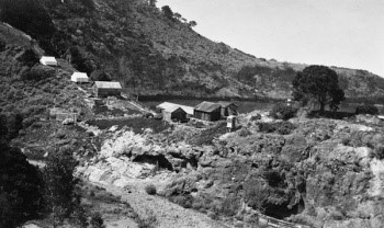
Eaton’s Resort at Pelican Bay – 1920
At that time, the only accommodations on Santa Cruz Island consisted of tents with wooden floors.* At night we could hear the wild hogs rooting around in the under brush which was scary. The food in the dining tent was plain but good with plenty of fresh fish.
A highlight of our stay was the trip into the blue caves. One entered their inner fastnesses in row boats. These caves were accessible only at low tide and in quiet waters. Within them, the water was a brilliant blue which became darker the further in we ventured. It was thrilling to trail one’s hand which yielded a ghostly phosphorescence. Back home again I had much to tell my less venturesome playmates.” – Elaine Adrian Willoughby
Sea Cave
I knew less about my father’s trip (or trips) to Santa Cruz Island. There was something about a borrowed Boston whaler, and that the wild boar they shot was so tightly wedged in a narrow canyon that they had to butcher it on site and deliver it piecemeal to the boat.
I can imagine that Santa Barbara in the early 1900s, with less than 10,000 inhabitants, was an ideal place for a boy to grow up. He and several co-conspirator built a shack up San Roque canyon until a wild-fire destroyed it. I have a small photo of him as a young teenager with his dad on a mountain trail, he with high boots, a slouch hat, and a canvas rucksack hanging heavily off his shoulders.
Now it was my turn.
TWO WHO CELEBRATE THE NATURAL WORLD
Hugh examines a damsel fly
HUGH RANSON – birder, teacher, and writer who writes the Saturday column “Bird Watch” for the Santa Barbara News Press. He began his bird watching as a boy in England.
In the last five years, he has taken up the study of dragonflies and during lunch breaks can often be found at a local pond with his net and camera.
Be sure and read an except from “Bird Watch” in the Blog “This Time for Work.”
Bill Dewey in his plane at the Santa Barbara airport
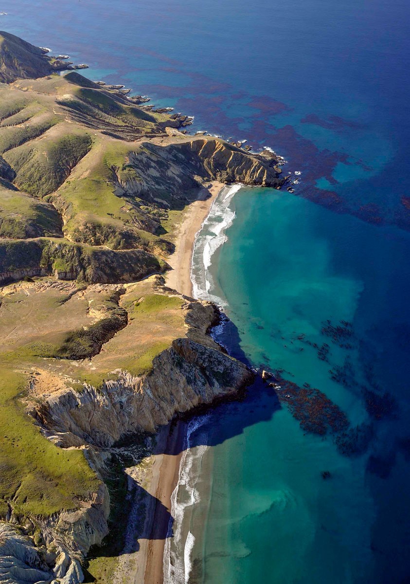
BILL DEWEY Bill has been photographing the California landscape since the early 1970s and has been flying since the 1980s. Some of his favorite subjects include the California Channel Islands, Carrizo plain, Baja California, and the rural California landscape. His work is widely published and shown in various galleries and museums. His aerial photos begin each my Santa Cruz Island blogs.
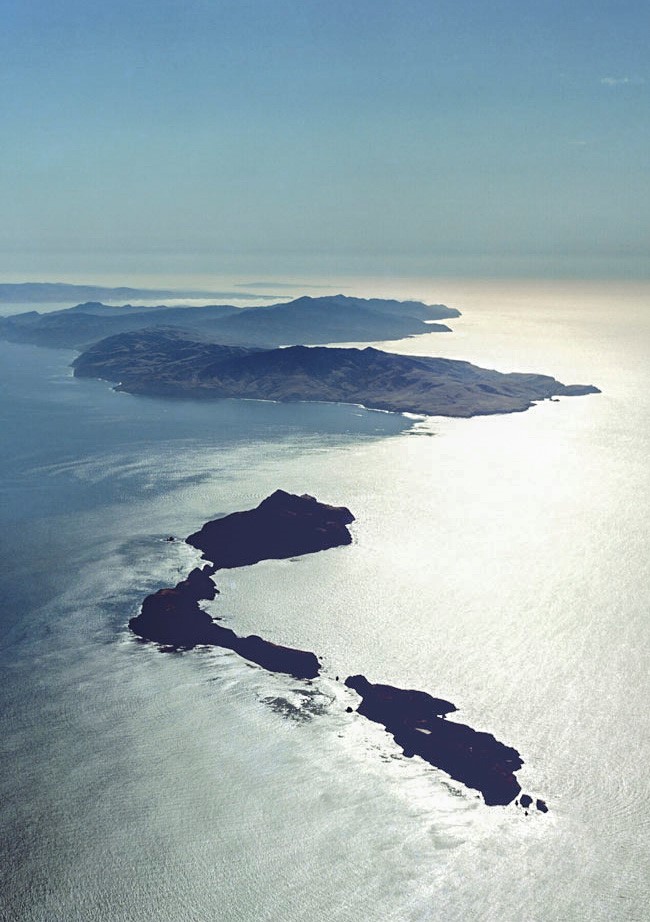
The Channel islands from the air, with Anacapa in the foreground, Santa Cruz, Santa Rosa, and San Miguel Island in the background. Photo by Bill Dewey
SANTA CRUZ ISLAND – THEN AND NOW
The Archipelago of the four Northern Channel Islands included westernmost San Miguel Island, Santa Rosa Island, the mountainous Santa Cruz Island, and finally little Anacapa with its “tail” of broken islets trailing behind. Now that I’ve settled in Santa Barbara where I most likely will conclude my life, I view the islands from the mainland, always drawn outward toward them. I see them from my daughter’s house high on the hillside above Mission Canyon, most often reclining on the horizon in their bed of haze. Sometimes the fog obscures them from view altogether, or there are times when the vapors are swept away by a dry north wind, and I can clearly see their cliffs and coves.
Over the years I’ve collected my own experiences of the islands. Last year, I crossed the choppy Channel on an Island Packers boat out of Ventura Harbor. I was lucky enough to have secured an invitation to the annual mass, thanks to Marla Daily, the head of the Santa Cruz Island Foundation.
Mass at the chapel
But my awareness of the islands, particularly Santa Cruz Island, began as a child when I read The Channel Islands of California, by Charles F. Holder, published in 1910 which I claimed from my parents’ library. The book with its turquoise-blue linen cover and the decorative drawings of the flying fish is now on my Santa Barbara bookshelf. I still love to reread the description of the ride in a horse-drawn carriage up the wild canyon to the Central Valley from the anchorage at Prisoners’ Harbor.
From “The Channel Islands of California”
Quoting from the book: “From the sea, Santa Cruz Island is a jumble of lofty hills and mountains, with deep gorges and canons winding in every direction.
Hidden away in the very heart of the island is an ideal ranch, with a pronounced foreign atmosphere, in a climate as perfect as that of Avalon to the south.”
“Seated in the trap, with our host holding the reins, we turned into a gorge… the road wound upward; the horses now splashing through the summer stream beneath gnarled and picturesque oaks, now out into the open, where the sun poured down through rifts in the cañon beneath a sky of tender blue, plunging into the narrow cañon again, where walls grew lofty and precipitous, shutting out the glare of sunlight; …”Three miles of this, and the charming canon road came to an abrupt end. The canon sides and the mountains suddenly melted away, and the horse dashed into a long, rolling valley, where the air was like velvet on the cheek and an incense of flowers and vines filled the nostrils.
But last Sunday it was in the cab of battered green truck driven by one of Marla’s relatives. Several trucks of various vintages were waiting for passengers who had disembarked from the boat tied up at the end of the green trucks brought us up from the boat long pier. I carefully climbed up the ladder, aided by the crew, to the rough planks of the pier. I was more uncertain than usual because I had fallen on the deck of the boat when a sudden lurch had tossed me down on my back.
Approaching the pier at Prisoners’ Harbor
I’d been pulled back upright without apparent injury though my confidence in staying upright had been challenged.
The streambed was dry the first mile or so but then we encountered water. We forded the stream several times “before the canyon sides and the mountains suddenly melted away.”
The ranch house in the Central Valley. Photo by Sally Isaacson. Courtesy of the SB Botanic Garden
It was different from when Holder had made the same trip a least a hundred years earlier. No longer a working ranch, most of the island now belongs to the Nature Conservancy. The vineyards which once traced the contours of the hills had been removed. Gone were the horses, cattle, and sheep. The ranch house was no longer ornamented with the iron grilles forged in the ranch forge.
The people this day were mainlanders who had come to enjoy the annual festivities, attend mass, drink wine and feast on the barbecue before returning to the mainland on the four o’clock boat.
A trip on Island Packers from Ventura to Santa Cruz Island
Leaving the mainland behind
Approaching Santa Cruz Island, Anacapa to the Left
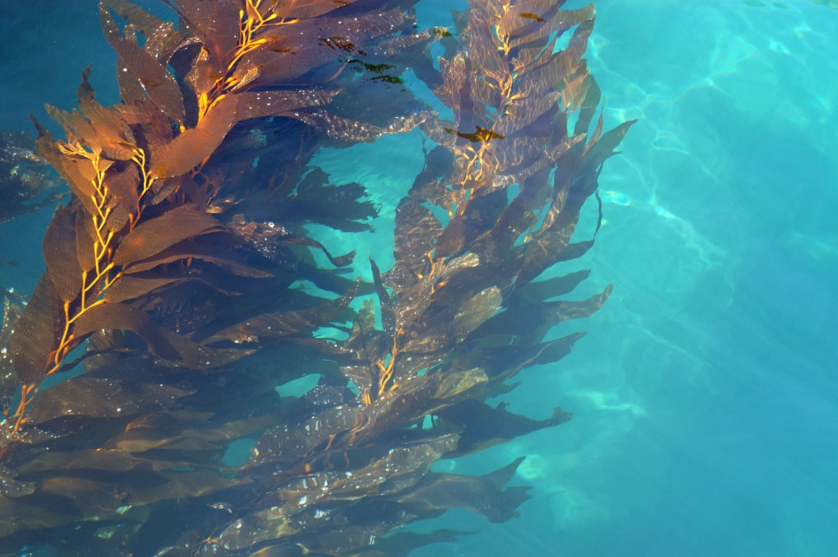
Giant Kelp. Photo by Bill Dewey
Hills surrounding the Central Valley
I mostly kept to myself, listening for bird songs and calls and finally spotting an Island fox. Mostly I tried to recapture in these dry hills the island of my dreams.
THIS TIME FOR WORK
(First published as “Island Exuberance” for Santa Barbara Magazine spring 94)
Near Christy Ranch. Photo by Bill Dewey
I’m drawn to all islands, but especially to those that lie off a mainland shore, like the Channel Islands. At times they beguile you, half hidden behind veils of fog, and at other times they abandon subtlety, revealing in dazzling detail their pale sea cliffs and shadowed canyons.
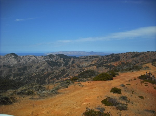
High road on the red rock ridge with Santa Rosa Island in the distance Photo by Steve Windhager Courtesy of the SB Botanic Garden
I don’t pretend to understand the power these islands have on me. Maybe it was the epic tales of sea voyages and island landfalls that fueled my imagination as a young reader. Or the stories told by my parents, who were raised in Santa Barbara. I made my first crossing to Santa Cruz Island, the largest island of the northern group, 25 years ago on a three-masted schooner. Since then I have managed to return often, usually as a participant in natural history groups or as a Nature Conservancy volunteer. Last spring, I volunteered as a plant monitor, and saw the island once again, this time from the back of a jeep as we lurched over ridgetop dirt roads on our way to inventory plants.
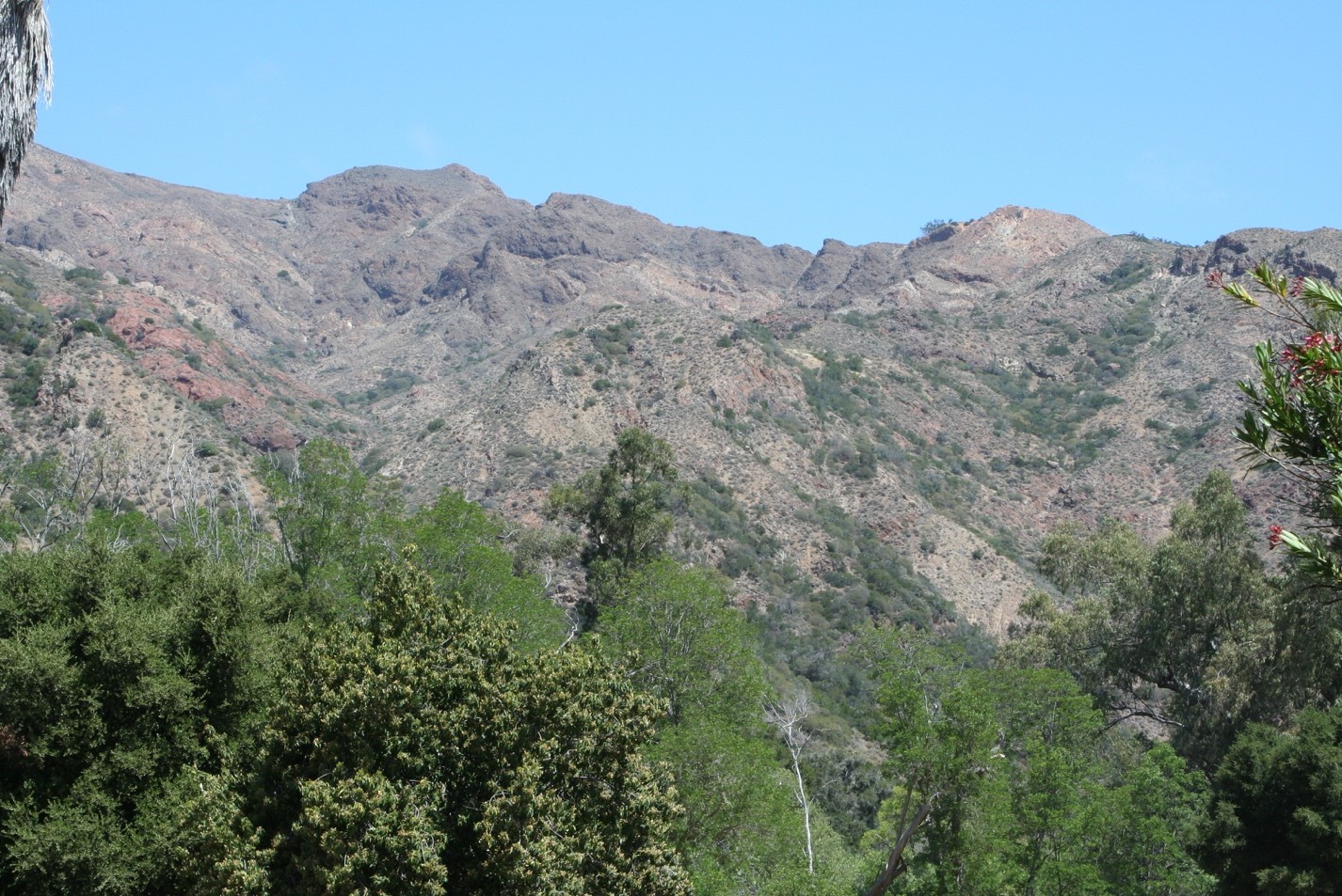
To the north was a mountain range of ruddy-colored volcanic rock. To the south toward the open sea rose a conical mountain peak of dazzling white rock know as the Blanca Volcanics. The island is, in fact, made up of two disparate land masses, that came from different directions and are sutured together by a fault know as the Central Valley. It is not hard to believe that this wild jumbled Technicolor landscape is still on the move, sliding northward toward the Aleutians. Some 18,000 years ago when the ocean level was lower, all four islands of the northern group were joined together in one super-island scientists refer to as “Santarosae”. Through the islands’ evolution many configurations developed, but they have not been joined to the mainland, at least not in recent geological times.
The plants and animals we see on Santa Cruz Island today came on the winds, were carried by ocean currents, or were brought ashore by human visitors. Salamanders and other stowaways came ashore on the same log rafts that the Chumash fashioned into canoes. Once on the island, many animals and plants have evolved distinctive forms
Island Fox. Photo by Joni Kelley. Courtesy of the SB Botanic Garde
On our trips around the island, we saw the little island fox that weighs barely three pounds. Other species are larger than their mainland cousins – examples of what scientists call gigantism. The Santa Cruz Island jay, for example, is bluer and 25 percent larger than the mainland Scrub Jay. Toyons and elderberries are shrubs or small trees on the mainland, but they can grow to 40-60 feet on the island. Maybe it’s the temperature, moist climate or lack of competitive species. I call it island exuberance. There are fewer species too, fewer kinds of birds, two types of snakes, and no burrowing animals at all. The four terrestrial animals are endemic, meaning they are found no place else.
This article and photo was excepted from “Bird Watch,” published each Saturday in the Santa Barbara News Press and written by Hugh Ranson.
Santa Cruz Island: the California Galapagos
One of the acorn-eating island scrub-jays. Photo by Hugh Ranson
I recently ventured out to Santa Cruz Island in search of migrant birds. While I didn’t see a great variety of migrants, there were enough resident species to keep me well entertained. Island foxes, which have made quite a comeback, trotted about throughout the day, seemingly unconcerned by human intrusion. Another island endemic, the island scrub jay, was much in evidence.
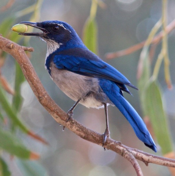
Hundreds of birders venture out to the island each year to see the jay. Why? It’s a species found nowhere else on earth. The island scrub jay was once considered conspecific with the California scrub jay, the familiar jay found commonly along our coast. It was officially recognized as a separate species in 1998. It is larger, much more brilliantly blue, has a larger beak, a different voice, and different social habits than its coastal cousin.
There are at least a couple of theories as to how the jay made its way to the island and began the slow differentiation from the mainland species. Jays are weak fliers and do not travel across large bodies of water. One thought is that jays made their way by hitching rides on floating vegetation. Another is that during a period of glaciation, when sea levels were lower, jays were able to cross the much narrower channel. At any rate, it is thought island jays have been isolated from the mainland for over 150,000 years.
Santa Cruz Island has a healthy population of jays estimated at 2,300 individuals. However, this population is considered vulnerable because of the small area of the island. There is the constant danger of fire, and more menacing still, the threat of West Nile Virus, to which corvids (jays are in the crow family) are particularly susceptible. Because of this latter threat, many of the jays have been captured and vaccinated.
It seems the island scrub jay is perhaps even more remarkable than we realized. Recently, biologist Kate Langin made a discovery that turned a theory of evolution on its head. She found that there are two separate populations of jays on the island, one that favors oak woodland, and one that inhabits pine forests. The oak-loving jays feed largely on acorns and have evolved shorter, stouter bills. The pine-inhabiting jays have longer, narrower bills, adapted for extracting pine nuts from pinecones. Even where pine and oak woodland are mere yards apart, the two populations appear to remain separate.
Charles Darwin theorized that in order for species to differentiate, like the famous Galapagos finches, there needs to be geographic separation. The island jays appear to be the first known instance where this theory doesn’t hold.
If you haven’t yet made it out to Santa Cruz Island, it’s time you did! Island Packers of Ventura run daily trips to the island. It takes a little over an hour to reach the island, and there are excellent opportunities for viewing marine mammals and birds on the crossing. There are two anchorages served by the company, Scorpion and Prisoners. You have an excellent chance of seeing the jay at Prisoners. It used to be that they were rarely seen at Scorpion, but in recent years they have become more common there, frequently foraging in the campground. I saw several there on my last visit. Scorpion also has many choices for coastal walking trails
Ironwood Grove. Photo by Steve Windhager. Courtesy of the SB Botanic Gardens
The scalloped-edged ironwood leaf resembles the splayed, scaly foot of some prehistoric bird. The light ripples as the tall trees sway in the sea breeze. In the presence of these shaggy-barked survivors, you can imagine these to be sacred groves. Islands have a way of compressing — and enlarging – human emotions, and island tales are replete with mysterious and sometimes tragic human stories. In the singularity of an island, you confront your own separateness, you own uniqueness. It’s been almost a year since my last island visit. Every day here on the mainland, I climb the hill behind my house to look seaward, hoping for a glimpse of the dark shapes on the horizon – elated when I can see them, a little lonely when they are obscured by fog or clouds.
TWO JAYS
Island Shrub-Jay
California Shrub-Jay
The Island Shrub-Jay was once thought to be a sub-species of our common coastal California Shrub-Jay, but now is recognized as a separate species. The Channel Islands have been separated for eons from the mainland. Jays being weak flyers, and with 25 miles of channel separating them, the Island Shrub-Jay has had a long time to develop its separate characteristics.
The Island jay is over all bigger (the beak especially so), the plumage is brighter and bluer and its cheek is near-black instead of gray.
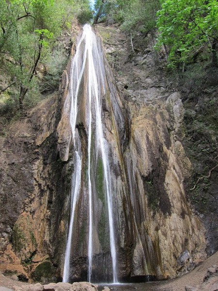
Sometimes it’s only a few thin bands of water dropping 164 feet. Other times it’s a gossamer tracery of water more mist than substance. It nourishes families of mosses and ferns growing on its walls. Only after a rain, does Nojoqui Falls aspire to something grander.
The falls (pronounced NAW- ho – wee) are named for a Chumash village “Naxuwi” once nearby.
When my granddaughter asked me what I wanted for my birthday, I said: “A day trip with you.” We talked about where and decided on a drive up the coast and inland to Nojoqui
Falls County Park, and then lunch at one of the good places in the Santa Ynez Valley. I wanted to walk along a creek and possibly even see falling water while it was still spring.
Driving up along the coast is a treat in itself. Once you’ve cleared the outskirts of Goleta you are in full view of the ocean and if the day is clear enough, you can see the profile of the islands on the horizon.
On the right, the Santa Ynez Mountains make a formidable barrier to the sea and its cool breezes. We passed three beach parks. On the landward side of the freeway, the beaches become canyons. Though beautiful on its own, the landscape stimulated memories – El Capitan Beach where grandson Stuart always wanted his birthday to be celebrated with a campout.
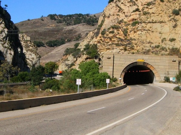
Just beyond Refugio Beach, the highway swings inland where ahead, the mountain wall is pierced by the Gaviota Tunnel. I thought about all those years when Santa Barbara could only be approached easily from the south.
At the sign “Nojoqui Falls County Park,” we left the noisy highway and dropped down to the Old Coast Highway and Alisal Road to the peace and quiet of farmlands. Once horse pastures, organic produce now grows in the soil enriched by manure.
Skirting the western edge of the mountains, we rounded the corner to the lush, north-facing slopes, the rainiest place in the county. How different from the south-facing slopes above Santa Barbara where the mountain slopes are dominated by bare sandstone and chaparral.
When we turned into the park with its broad meadow and a scattering of trees, Caroline said: “This reminds me of Yosemite Valley.” I could see her point except that when every detail of a beloved place like Yosemite is so perfectly embedded in my memory, nothing can compare.
We drove up to the end of the road where a few cars were parked. At the base of the canyon, a short trail leads up to the falls.. Starting up the trail I was transported to the Berkeley Hills where bay trees also form arches of fragrant leaves and the sun shines through the thin leaves of the big-leaved maples. The creek burbling over dark rocks reminded me of the dark-gray basalts of home.
The final ascent on stone steps to the base of the falls looked damp, making them especially perilous for my old legs. A bench at their base invited me to sit a while, let my granddaughter
Warbling Vireo
trot ahead while I listened to the creek and the cascade of Warbling Vireo songs spilling down from the bay trees overhead. Click here to listen to their song.
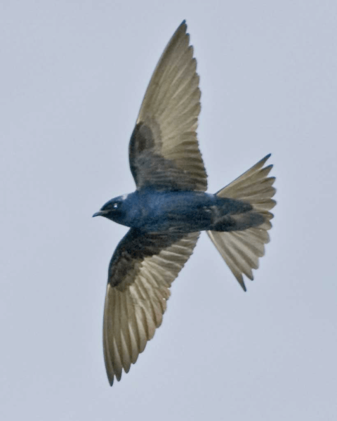
Purple Martin
Purple Martins are our largest and highest-flying swallow. They perform breath-taking acrobatics when hunting insects. At the park, martins ignore man-made boxes in favor of holes in the sycamore trees.
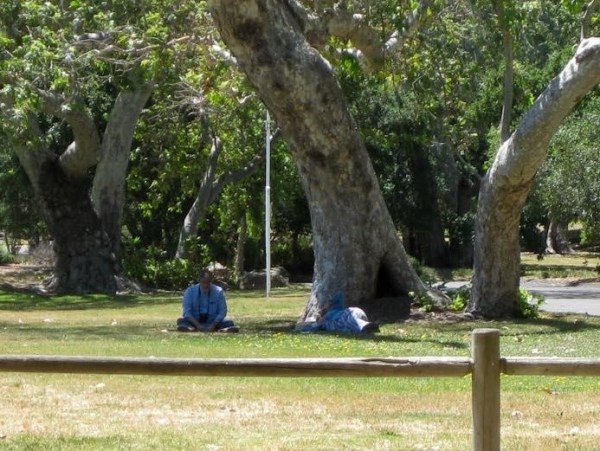
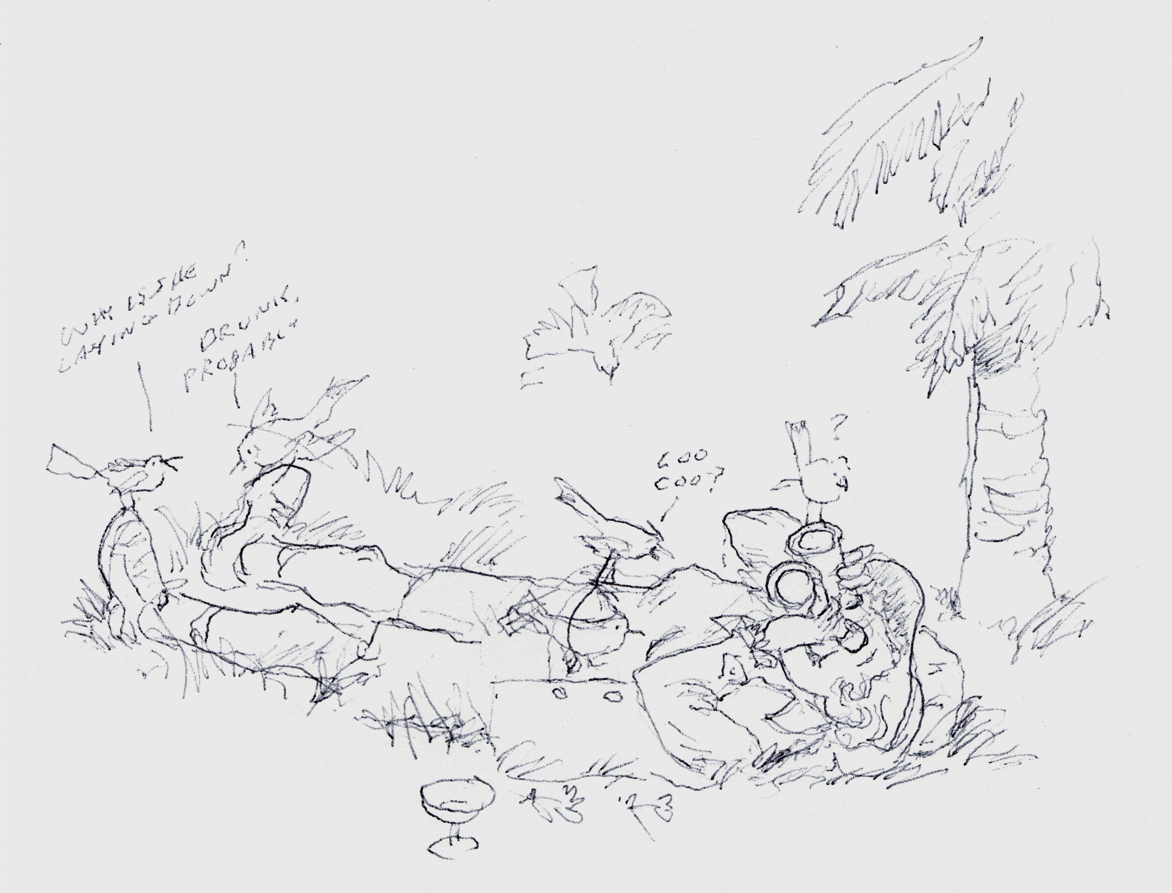
Three weeks later with Berkeley birding friends, Bob Lewis and his wife, Hanno, we returned to Nojoqui Falls park to find the Purple Martins. Bob is sitting on the left. The heap on the right is actually me lying on my side watching martins in flight. Stretched out, has become my preferred position for watching birds of the sky and for general cloud-spotting.(I highly recommend to others who love clouds “The Cloudspotter’s Guide by Gavin Pretor-Pinney – the founder of The Cloud Appreciation Society)
Varied Thrush
Now we will be leaving the park to the summer crowds, returning in the fall to see the winter birds like the beautiful Varied Thrush.
If you have lived a natural life say as a manzanita bush on the slope of the San Ynez Mountains you will understand the true meaning of summer. You will have grown new foliage or lengthened the leaves you have during late winter or early spring. You will have flowered and welcomed the bees. Now the flowers have turned into fruit, it’s time to let them ripen in the warm sun of the long days. It’s a season for repose or maybe deepening, as your tap root reaches down further to find water.
After such a sumptuous winter how could it not be – a perfect spring.
I came to Santa Barbara to live in September 2013, the second year of the drought. The landscape was dry, but as a native Californian, I expected dryness. The winter rains the next two years were scanty. Not only did the garden lawns die by intent, but landscape and street trees began suffering. Many of the redwoods, never a good choice for this semi-arid climate, were dying. The conifers were the hardest hit. The native ponderosa pines on Figueroa Mountain all succumbed, probably weakened by the drought and then attacked by the deadly bark beetle. To try and save street trees, the city attached green plastic reservoirs to young trees which slowly released water to the roots.
Maybe several times during the winter, enough rain would fall to feed the headwaters of various creeks. Mission Creek with its springs high on mountain sides above the Botanic Garden came briefly to life with muddy torrents of water which rushed down the dry creek bed. Quickly depleted, the flow stopped and by the second day, the creek became isolated pools. By the third day, the creek disappeared all together.
California Poppies
With the return to silent stretches of dry rock, my spirits fell. I realized again how above all the landscape features – hills, mountains, valleys, and especially the noisy, restless ocean – it is creeks I love the best, for their cheerful sounds and their ability to be a magnet for surrounding life.
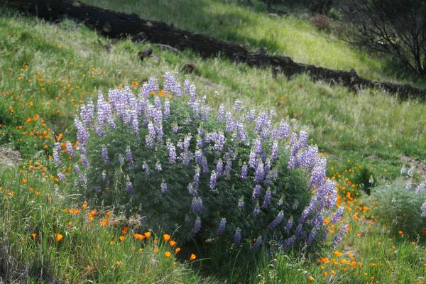
Bush lupine
Spring in California is mostly about wildflowers, but in one of the ironies of a wet spring, grass and weeds growing tall often concealed the flowers. Figueroa Mountain had some nice displays, particularly where lupine grew on perennial shrubs or where poppies grew on serpentine soil which inhibits the rampant growth of grass.
It was in the semi-desert areas like Carizzo Plain, an hour and a half drive inland from San Luis Obispo, where the flowers were amazing, enough so, to gain the title — superbloom. Hills and the desert floors look as if they’d been splashed with paint.
But it is in the exuberance of the commoner plants that I saw the results of a wet winter. The wild oats, now going to seed are waist high, and must compete for space with wild radishes and Italian thistle.
After four years of drought that tested their endurance, allowing no luxury like new growth, live oaks this spring were transformed with explosions of tender bright green leaves. The shiny leaves concealed the coarse and somber, dark green foliage, some of which could now be shed.
New spring growth on the live oaks
Live oaks are the most abundant native tree of Samarkand, Oak Park and most lowland locations.
Best of all was to see Mission Creek behaving like a real stream, not with just the episodic flow of two days that followed a rain during the preceding drought years. My morning ritual was to look through my binoculars into the small gap between the trees where I could see the overlapping brightness of moving water. The stream had a rhythm, sometimes squeezing around rocks making music and then released, spreading out in quiet pools, before being narrowed again. I think I could write a score with the proper notations.
The male flowers are heavy with pollen which will be released by the wind to fertilize some of the female flowers growing on the same tree. From the fertilized female flower comes the familiar acorn.
I imagine my father, who grew up near Oak Park, capturing tadpoles with a net, or creating a new flow by rearranging rocks. When the flow was strongest, he and his buddies, no doubt, fashioned boats and then ran along the creek edge to see how they fared.
Two weeks after the last rain in March, the flow began to shrink, imperceptivity at first. But now in mid-April the creek has disappeared. Or, perhaps it flows beneath the surface still accessible to the roots of trees.
Oxalis, considered a hard-to-get-rid-of weed by most gardeners, crowded roadsides after this year’s heavy rains
Speculation has already begun about next winter. Through summer and early fall, conditions appear to be “neutral” with early signs of building El Nino conditions beginning later in the fall. In most years, a strong El Nino brings generous rains, but not always. Speculation, especially about future weather, is irresistible especially for weather buffs like myself.
In this most luxuriant of springs no slope is unclaimed. Here, nasturtiums have naturalized a hillside.


 “Seated in the trap, with our host holding the reins, we turned into a gorge… the road wound upward; the horses now splashing through the summer stream beneath gnarled and picturesque oaks, now out into the open, where the sun poured down through rifts in the cañon beneath a sky of tender blue, plunging into the narrow cañon again, where walls grew lofty and precipitous, shutting out the glare of sunlight; …”Three miles of this, and the charming canon road came to an abrupt end. The canon sides and the mountains suddenly melted away, and the horse dashed into a long, rolling valley, where the air was like velvet on the cheek and an incense of flowers and vines filled the nostrils.
 But last Sunday it was in the cab of battered green truck driven by one of Marla’s relatives. Several trucks of various vintages were waiting for passengers who had disembarked from the boat tied up at the end of the green trucks brought us up from the boat long pier. I carefully climbed up the ladder, aided by the crew, to the rough planks of the pier. I was more uncertain than usual because I had fallen on the deck of the boat when a sudden lurch had tossed me down on my back.


 The final ascent on stone steps to the base of the falls looked damp, making them especially perilous for my old legs. A bench at their base invited me to sit a while, let my granddaughter
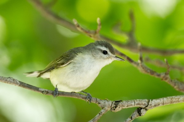
 Three weeks later with Berkeley birding friends, Bob Lewis and his wife, Hanno, we returned to Nojoqui Falls park to find the Purple Martins. Bob is sitting on the left. The heap on the right is actually me lying on my side watching martins in flight. Stretched out, has become my preferred position for watching birds of the sky and for general cloud-spotting.(I highly recommend to others who love clouds “The Cloudspotter’s Guide by Gavin Pretor-Pinney – the founder of The Cloud Appreciation Society)
 If you have lived a natural life say as a manzanita bush on the slope of the San Ynez Mountains you will understand the true meaning of summer. You will have grown new foliage or lengthened the leaves you have during late winter or early spring. You will have flowered and welcomed the bees. Now the flowers have turned into fruit, it’s time to let them ripen in the warm sun of the long days. It’s a season for repose or maybe deepening, as your tap root reaches down further to find water.